Start Point

Information office Scharnitz (P2)

End Point

Information office Scharnitz (P2)

Difficulty

Medium

Total Distance

38,00 km

Descent Meters

832 m

Ascent Meters

832 m

Highest Point

1768 m

Total Time

06:00 h

Map & Elevation Profile

Start Point

Information office Scharnitz (P2)

End Point

Information office Scharnitz (P2)

Difficulty

Medium

Total Distance

38,00 km

Descent Meters

832 m

Ascent Meters

832 m

Highest Point

1768 m

Total Time

06:00 h

Hiking

Best Time

Jan

Feb

Mar

Apr

May

Jun

Jul

Aug

Sep

Oct

Nov

Dec

Bike & Hike

Hiking tour

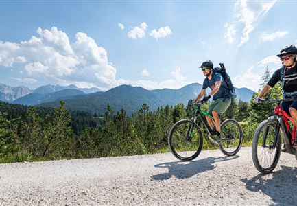
Very long hike that requires good physical condition. To save time it is advisable to cycle to the Kastenalm and then continue on foot to the Hallerangerhaus.
From the information office Scharnitz from Isarlodge Wiesenhof, continue to Gleirschhöhe. From there take the left forest road in the direction of Isarursprung. Park your bike just before the Kastenalm and cross a small bridge. Then steeply uphill past the Lafatscher Niederleger to the Halleranger. Arrived at the Almboden, the paths divide, here right to the Hallerangerhaus or continue the path to the Hallerangeralm.

For those who want a sneak peek, here are two videos:


Return to the starting point along the same path.

Details for one direction:
  • Bike route nr. 578: approx. 14 km, 300 hm uphill, 01:30 h, difficulty: easy (Time there and back: 2h)
  • Hike route: approx. 7 km, 530 hm uphill, 02:30 h, difficulty: medium (Time there and back: 4h)

For those who want to extend the tour, there is the Bike & Hike Tour to Speckkarspitze.

Features & Characteristics

Stamina

Technique

Start Point

Information office Scharnitz (P2)

End Point

Information office Scharnitz (P2)
Similar Tour Suggestions

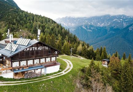
Rauthhütte in Leutasch

Hiking

Circular hiking to Rauthhütte alpine hut & Inntal Valley view

Length

6,20 km

Duration

03:00 h

Uphill

439 hm

Altitude

1599 hm

Difficulty

Medium

Leutascher Geisterklamm mit Blick Richtung Mittenwald.jpg

Hiking

Long Gorge Trail through the Leutasch Spirit Gorge with Themed Trail

Length

3,20 km

Duration

01:30 h

Uphill

129 hm

Downhill

127 hm

Altitude

1060 hm

Difficulty

Medium

Isarursprung im Karwendel - Scharnitz (3).jpg

Hiking

Hike to the source of the river Isar & Kasten alpine hut

Length

28,20 km

Duration

06:00 h

Uphill

323 hm

Altitude

1227 hm

Difficulty

Medium

Wanderung zur Eppzirler Alm im Sommer - Mann und Frau von hinten mit Eppzirler Alm.jpg

Hiking

Hike to the Eppzirler Alm alpine hut

Length

12,40 km

Duration

04:00 h

Uphill

475 hm

Altitude

1459 hm

Difficulty

Medium

Brunschkopf_inkl_Logo.jpg

Hiking

Brunschkopf viewing platform via Geiernest from Seefeld, return via Wildmoosalm

Length

9,20 km

Duration

03:15 h

Uphill

316 hm

Downhill

313 hm

Altitude

1493 hm

Difficulty

Medium

Bike Tour durchs Karwendeltal aufs Karwendelhaus - Scharnitz (13).jpg

Hiking

Bike & Hike Kristenalm

Length

25,00 km

Duration

04:00 h

Uphill

420 hm

Altitude

1249 hm

Difficulty

Medium

Familien-Weitwanderung im Gaistal - Familie vor Hohe Munde - Alle lächeln.jpg

Hiking

Complete Route for the Leutasch 3-Day Hut Hike for Families

Length

16,20 km

Duration

10:00 h

Uphill

960 hm

Altitude

2132 hm

Difficulty

Medium

Wanderweg zur Hohen Fluder mit Blick Richtung Hohe Munde.jpg

Hiking

Hike Hoher Sattel

Length

10,60 km

Duration

04:00 h

Uphill

524 hm

Altitude

1620 hm

Difficulty

Medium