Start Point

Parking P15 Music Pavilion Leutasch

End Point

Parking P15 Music Pavilion Leutasch

Difficulty

Medium

Total Distance

3,50 km

Descent Meters

181 m

Highest Point

1277 m

Total Time

01:30 h

Map & Elevation Profile

Start Point

Parking P15 Music Pavilion Leutasch

End Point

Parking P15 Music Pavilion Leutasch

Difficulty

Medium

Total Distance

3,50 km

Descent Meters

181 m

Highest Point

1277 m

Total Time

01:30 h

Hiking

Best Time

Jan

Feb

Mar

Apr

May

Jun

Jul

Aug

Sep

Oct

Nov

Dec

Hiking tour

Circular hike

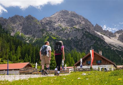
The hike starts at parking lot P15 near the music pavilion in Leutasch and first leads towards Unterweidach, passing by the MPreis supermarket. After about 150 meters, the trail turns right and continues to the Landhaus "Knaus".

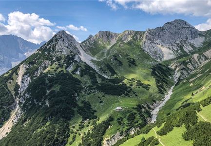
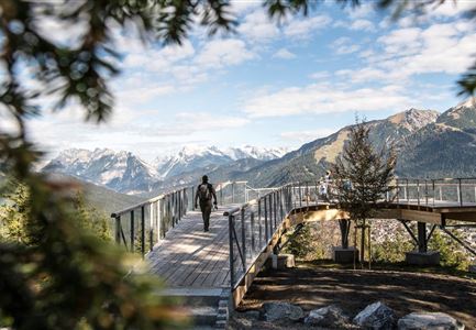
From there, the path begins to climb on a narrow trail through the Leutasch mixed forest. The steady ascent is accompanied by the scent of the trees and the soft rustling of the forest. After about 45 minutes, the Kurblhang panorama platform is reached – a perfect spot for a short break. The view stretches far across the Wetterstein mountains and the Hohe Munde.

The descent follows the signs to Weidach and eventually leads back to the starting point. A varied route with impressive views and peaceful forest sections.

Features & Characteristics

Start Point

Parking P15 Music Pavilion Leutasch

End Point

Parking P15 Music Pavilion Leutasch

Family-friendly

Yes

Loop tour

Yes

Similar Tour Suggestions

Hallerangeralm

Hiking

Bike & Hike Sunntigerspitze Summit, 2,321 m

Length

42,00 km

Duration

09:00 h

Uphill

1396 hm

Altitude

2321 hm

Difficulty

Medium

Brunnsteinhütte

Hiking

Hike to the Brunnsteinhütte

Length

10,00 km

Duration

04:30 h

Uphill

668 hm

Altitude

1523 hm

Difficulty

Medium

Pleisenhütte im Sommer - Scharnitz - quer.jpg

Hiking

Hike to the Pleisen alpine hut

Length

15,90 km

Duration

05:00 h

Uphill

780 hm

Downhill

774 hm

Altitude

1757 hm

Difficulty

Medium

Blick auf das Wettersteingebirge mit Neuleutasch im Sommer - Luftaufnahme.jpg

Hiking

Circular hike from Seefeld to Gießenbach & Leutasch

Length

21,50 km

Duration

06:30 h

Uphill

773 hm

Downhill

815 hm

Altitude

1616 hm

Difficulty

Medium

Leutascher Geisterklamm mit Blick Richtung Mittenwald.jpg

Hiking

Long Gorge Trail through the Leutasch Spirit Gorge with Themed Trail

Length

3,20 km

Duration

01:30 h

Uphill

129 hm

Downhill

127 hm

Altitude

1060 hm

Difficulty

Medium

Brunschkopf_inkl_Logo.jpg

Hiking

Brunschkopf viewing platform via Geiernest from Seefeld, return via Wildmoosalm

Length

9,20 km

Duration

03:15 h

Uphill

316 hm

Downhill

313 hm

Altitude

1493 hm

Difficulty

Medium

Hölzernes Herz am Mühlberg in Scharnitz - Perspektive durch Gebüsch (1).jpg

Hiking

Hike to the Mühlberg Scharnitz

Length

6,50 km

Duration

02:30 h

Uphill

334 hm

Downhill

328 hm

Altitude

1315 hm

Difficulty

Medium

Durch die Gleirschklamm bei Scharnitz.jpg

Hiking

Circular hiking trail Gleirschklamm Gorge

Length

13,10 km

Duration

04:00 h

Uphill

416 hm

Downhill

410 hm

Altitude

1152 hm

Difficulty

Medium