Start Point

Leutasch Parking P13 Puitbach/ Ahrn

End Point

Leutasch Parking P13 Puitbach/ Ahrn

Difficulty

Hard

Total Distance

22,80 km

Descent Meters

1319 m

Ascent Meters

1319 m

Highest Point

2367 m

Total Time

10:00 h

Map & Elevation Profile

Start Point

Leutasch Parking P13 Puitbach/ Ahrn

End Point

Leutasch Parking P13 Puitbach/ Ahrn

Difficulty

Hard

Total Distance

22,80 km

Descent Meters

1319 m

Ascent Meters

1319 m

Highest Point

2367 m

Total Time

10:00 h

Hiking

Best Time

Jan

Feb

Mar

Apr

May

Jun

Jul

Aug

Sep

Oct

Nov

Dec

Hiking tour

Circular hike

Very long hike that requires good physical condition.

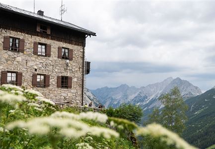
Attention: The Wetterstein Hut remains closed until further notice.


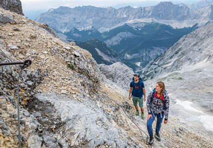
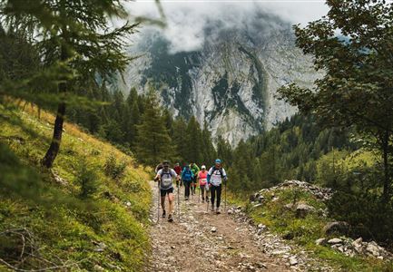
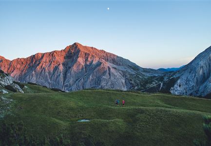
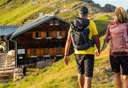
The starting point for the hike to the Gehrenspitze is the Puitbach/Ahrn parking lot (P13) in Leutasch (fee required). From here, follow the signs to the left along the path to the Puittal valley. This valley delights with untouched nature and paradisiacal views of the surrounding mountains. Under the high towers of the Öfelekopf, the Leutascher Dreitorspitze and the walls of the Gehrenspitze, you climb further and further up through the lush green valley. The flora and fauna with countless mountain herbs is also unique. With a little luck, you will encounter chamois or marmots that call the Puittal their home.

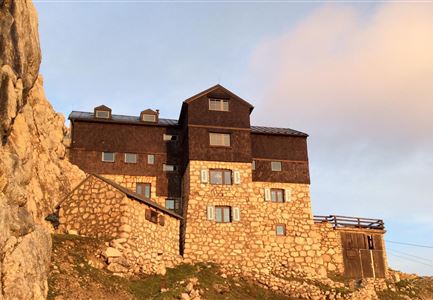
At first, you have to overcome a few steep meters in altitude, but these pay off at the Scharnitzjoch at the latest. After about 3 hours you reach it and can look forward for the first time to magnificent views of the Gaistal. Also the Wangalm and Wettersteinhütte can now be seen from here. The trail continues via the small Erinnerungshütte (not managed) towards the summit of the Gehrenspitze. The path becomes narrower and

Features & Characteristics

Stamina

Technique

Start Point

Leutasch Parking P13 Puitbach/ Ahrn

End Point

Leutasch Parking P13 Puitbach/ Ahrn

Loop tour

Yes
Similar Tour Suggestions

Gipfel Grosse Arnspitze - Scharnitz.jpg

Hiking

Hike to the Große Arnspitze Summit, 2,196 m

Length

9,00 km

Duration

07:30 h

Uphill

1247 hm

Altitude

2196 hm

Difficulty

Hard

Sonnenuntergang Hohe Munde_Ostgipfel

Hiking

Hike Hohe Munde Summit, 2.592 m

Length

11,30 km

Duration

09:00 h

Uphill

1410 hm

Altitude

2562 hm

Difficulty

Hard

Meilerhütte

Hiking

Hike to the Meilerhütte alpine hut

Length

18,90 km

Duration

10:00 h

Uphill

1420 hm

Altitude

2370 hm

Difficulty

Hard

toni-gaugg-weg_im_karwendel_wanderer_macht_bild.jpg

Hiking

Toni Gaugg Trail: High-Alpine Ridge Route from the Pleisenhütte to the Karwendelhaus

Length

12,74 km

Duration

08:00 h

Uphill

1200 hm

Altitude

2506 hm

Difficulty

Hard

Weidachsee in Leutasch am Morgen - Luftaufnahme.jpg

Hiking

Wheelchair Circular Walk around the Weidachs

Length

3,00 km

Duration

00:45 h

Uphill

10 hm

Altitude

1120 hm

Difficulty

Hard

Hohe Gleirsch_2.jpg

Hiking

Bike & Hike Hoher Gleirsch Summit, 2,492 m

Length

31,00 km

Duration

09:30 h

Uphill

1772 hm

Altitude

2492 hm

Difficulty

Hard

Wanderer auf dem Predigtstuhl.jpg

Hiking

Bike & Hike Predigtstuhl Summit, 2,234 m

Length

19,00 km

Duration

04:30 h

Uphill

1015 hm

Altitude

2234 hm

Difficulty

Hard

Blick auf Arnspitzen Ueberschreitung - Scharnitz

Hiking

Mountain tour crossing of the Arnspitzen

Length

11,50 km

Duration

08:30 h

Uphill

1353 hm

Altitude

2196 hm

Difficulty

Hard