Start Point

Seefeld Valley Station Bergbahnen Rosshütte

End Point

Seefeld Valley Station Bergbahnen Rosshütte

Difficulty

Hard

Total Distance

20,40 km

Descent Meters

1464 m

Ascent Meters

1464 m

Highest Point

2231 m

Total Time

10:00 h

Map & Elevation Profile

Start Point

Seefeld Valley Station Bergbahnen Rosshütte

End Point

Seefeld Valley Station Bergbahnen Rosshütte

Difficulty

Hard

Total Distance

20,40 km

Descent Meters

1464 m

Ascent Meters

1464 m

Highest Point

2231 m

Total Time

10:00 h

Hiking

Best Time

Jan

Feb

Mar

Apr

May

Jun

Jul

Aug

Sep

Oct

Nov

Dec

Hiking tour

Circular hike

This tour is long, steep, and demanding – 20.4 kilometers and 1,460 meters of elevation gain require good fitness, endurance, and surefootedness.

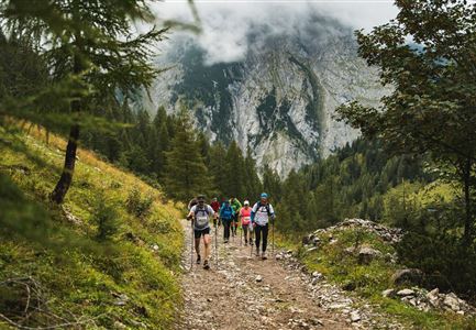
The hike starts at the valley station of the Bergbahnen Rosshütte. First, follow the Römerweg (No. 6) towards Gießenbach – a wide path that is great for warming up. At the next junction, turn right onto trail No. 70 towards Schlagkopf. From here, the ascent becomes noticeably steeper.

The route continues along trails No. 73 and 212 to the Eppzirler Alm – a great place to take a short break and rest at the rustic mountain hut.

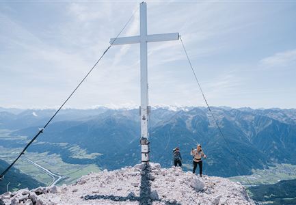
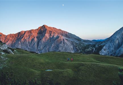
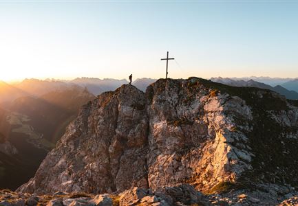
After recharging, the most demanding section of the tour begins. The ascent to Ursprungssattel on trail No. 74 is long and challenging. The path gets steeper, the terrain rockier, and the elevation gain is now really noticeable in the legs. But once at the top, the view of the impressive high-alpine landscape makes it all worthwhile.

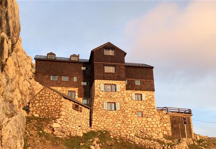
After this tough climb, you finally reach the Nördlinger Hütte – the perfect place for a well-deserved break.

But the descent is also challenging: A steep trail (No. 84) leads down to the Reitherjoch Alm. After such a

Features & Characteristics

Start Point

Seefeld Valley Station Bergbahnen Rosshütte

End Point

Seefeld Valley Station Bergbahnen Rosshütte

Loop tour

Yes

Similar Tour Suggestions

Hohe Gleirsch_2.jpg

Hiking

Bike & Hike Hoher Gleirsch Summit, 2,492 m

Length

31,00 km

Duration

09:30 h

Uphill

1772 hm

Altitude

2492 hm

Difficulty

Hard

Falkenhütte neu

Hiking

Karwendelmarsch 52 km

Length

52,00 km

Duration

19:00 h

Uphill

2281 hm

Downhill

2217 hm

Altitude

1903 hm

Difficulty

Hard

Blick auf Arnspitzen Ueberschreitung - Scharnitz

Hiking

Mountain tour crossing of the Arnspitzen

Length

11,50 km

Duration

08:30 h

Uphill

1353 hm

Altitude

2196 hm

Difficulty

Hard

Meilerhütte

Hiking

Hike to the Meilerhütte alpine hut

Length

16,90 km

Duration

09:00 h

Uphill

1390 hm

Altitude

2371 hm

Difficulty

Hard

Nördlinger Hütte - Wanderer kurz vor der Hütte (2).jpg

Hiking

Circular hike to the Nördlinger Hütte alpine hut & Reither Spitze Summit, 2,374m

Length

9,90 km

Duration

07:30 h

Uphill

1191 hm

Altitude

2374 hm

Difficulty

Hard

Grosse Arnspitze Blick ins Karwendel - Scharnitz

Hiking

Hike Hoher Sattel - Große Arnspitze Summit, 2,196 m

Length

10,30 km

Duration

08:00 h

Uphill

1313 hm

Altitude

2196 hm

Difficulty

Hard

Wanderung auf die Birkkarspitze - Scharnitz (65).jpg

Hiking

Hike from the Karwendelhaus to the Hinterautal

Length

9,20 km

Duration

07:00 h

Uphill

883 hm

Altitude

2642 hm

Difficulty

Hard

Wanderer auf der Gehrenspitze ueber Leutasch im Sonnenaufgang - Panoramaaufnahme.jpg

Hiking

Hike to the Gehrenspitze, 2,367 m

Length

22,80 km

Duration

10:00 h

Uphill

1319 hm

Altitude

2367 hm

Difficulty

Hard