We use cookies for your personalized browsing experience, to personalize content and ads, to provide social media features, and to analyze traffic to our website. We also share information about your use of our website with our social media, advertising and analytics partners. Our partners may combine this information with other data that you have provided to them or that they have collected as part of your use of the Services. (incl. US providers)

Start Point

Reith parking Maxhütte

End Point

Reith parking Maxhütte

Difficulty

Hard

Total Distance

9,10 km

Descent Meters

1161 m

Ascent Meters

1161 m

Highest Point

2374 m

Total Time

07:30 h

Map & Elevation Profile

Start Point

Reith parking Maxhütte

End Point

Reith parking Maxhütte

Difficulty

Hard

Total Distance

9,10 km

Descent Meters

1161 m

Ascent Meters

1161 m

Highest Point

2374 m

Total Time

07:30 h

Hiking

Best Time

Jan

Feb

Mar

Apr

May

Jun

Jul

Aug

Sep

Oct

Nov

Dec

Hiking tour

Summit tours

+2

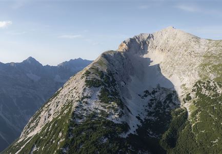
Route: Reith Maxhütte - Nördlinger Hütte - Reither Spitze - Reitherjoch Alm - Reith Maxhütte

Parking facility:

P6 "Maxhütte

Directions:

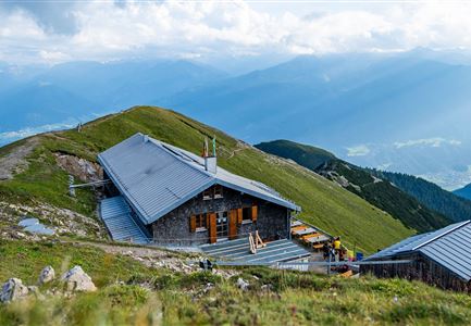
From the paid parking area Maxhütte up the road and then right along the bee trail to the junction Nördlinger Hütte. Follow the panoramic path, then turn left on the narrow Stieglweg and the Reitherspitzsteig up to the Nördlinger Hütte (alpine hut), where you can enjoy a magnificent view.

There are 2 variants for the way back:

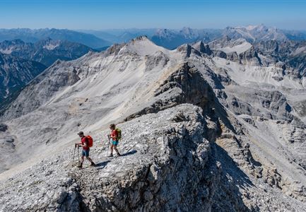
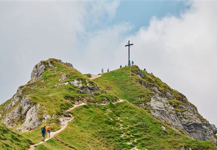
  • Variant 1 - as shown in the map: From the Nördlinger hut further on the Reither Spitze (2,374m)  to the Härmelekopf (only for experienced hiker,  sure-footed and free from giddiness, it goes over a ladder), further to the Reitherjoch Alm and back to the Maxhütten parking lot.

  • Variant 2: The same way back to the Nördlinger hut and directly in front of the hut left down to the Reitherjoch Alm and further back to the Maxhütten parking lot. A trail for experienced hikers who are free from giddiness.


Alpine emergency call:

Call: 140

Features & Characteristics

Start Point

Reith parking Maxhütte

End Point

Reith parking Maxhütte

Loop tour

Yes

Similar Tour Suggestions

Seekirchl in Seefeld

Hiking

Circular walking path from Seefeld to the lake Möserer See

Length

8,80 km

Duration

02:30 h

Uphill

231 hm

Altitude

1297 hm

Difficulty

Easy

Kurblhang - Leutasch (2).jpg

Hiking

Circular hiking trail viewpoint Kurblhang

Length

3,50 km

Duration

01:30 h

Uphill

181 hm

Altitude

1277 hm

Difficulty

Medium

Kaltwassersee auf der Rosshütte über Seefeld

Hiking

Circular hiking traill to the Rosshütte alpine hut - Hochegg Alm alpine hut

Length

8,30 km

Duration

03:45 h

Uphill

515 hm

Altitude

1740 hm

Difficulty

Medium

Bahnhof in Reith mit Blick über das Inntal in der Region Seefeld

Hiking

Circular hike from Seefeld to Auland & Reith

Length

8,90 km

Duration

02:30 h

Uphill

122 hm

Altitude

1199 hm

Difficulty

Easy

Karwendelhaus neu

Hiking

Hike from the Karwendelhaus to the Hinterautal

Length

9,20 km

Duration

07:00 h

Uphill

883 hm

Altitude

2642 hm

Difficulty

Hard

Rotmoosalm mit Spielplatz, Kreuz und Sonnenterrasse im Sommer

Hiking

Hike to the Rotmoosalm alpine hut

Length

9,00 km

Duration

05:30 h

Uphill

842 hm

Altitude

2037 hm

Difficulty

Medium

Open
Pleisenhütte Sommer

Hiking

Hike to the Pleisenspitze Summit, 2,569 m

Length

20,10 km

Duration

09:30 h

Uphill

1600 hm

Altitude

2569 hm

Difficulty

Hard

Herbst am Möserer See - Frau am Ufer (Edit 2).jpg

Hiking

Circular walking path lake Möserer See & Kalvarienberg

Length

2,70 km

Duration

01:15 h

Uphill

73 hm

Altitude

1288 hm

Difficulty

Easy