Start Point

Leutasch Bus Stop Ostbach

End Point

Leutasch Bus Stop Ostbach

Difficulty

Easy

Total Distance

11,50 km

Descent Meters

220 m

Ascent Meters

220 m

Highest Point

1345 m

Total Time

03:30 h

Map & Elevation Profile

Start Point

Leutasch Bus Stop Ostbach

End Point

Leutasch Bus Stop Ostbach

Difficulty

Easy

Total Distance

11,50 km

Descent Meters

220 m

Ascent Meters

220 m

Highest Point

1345 m

Total Time

03:30 h

Hiking

Best Time

Jan

Feb

Mar

Apr

May

Jun

Jul

Aug

Sep

Oct

Nov

Dec

Hiking tour

Hut hike

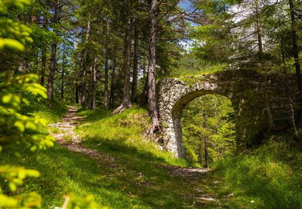
The hike starts at the bus stop in Ostbach. At first, the route follows the main road for a short stretchbe extra careful here! After a short walk, you reach the Ostbach Bridge, where the trail turns onto Schlagweg No. 3 towards Muggenmoos Alm. From here, the path steadily climbs uphill through the forest on a well-maintained trail.

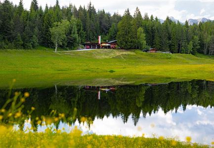
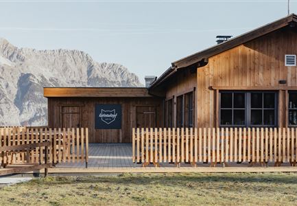
After passing through the forest, the trail leads left past Rauthgatter to Ferienheim Wildmoos (not serviced). From there, the path continues to the Wildmoosalm, which sits beautifully in an alpine meadow and offers a great place to stop and rest.

Note: There are no parking spaces directly at the starting point. Those arriving by car can park at parking lot Munde (P18) and walk to the Ostbach bus stop to begin the hike.

Features & Characteristics

Start Point

Leutasch Bus Stop Ostbach

End Point

Leutasch Bus Stop Ostbach

Family-friendly

Yes
Similar Tour Suggestions

Blick ueber Wildmoos nach Seefeld.jpg

Hiking

Circular tour around the Brunschkopf

Length

13,10 km

Duration

04:00 h

Uphill

275 hm

Downhill

272 hm

Altitude

1369 hm

Difficulty

Easy

Familie beim Wandern am Kaltwassersee - Seefeld (1) Kopie.jpg

Hiking

Stone Pine Trail Rosshütte Mountain Station

Length

662 m

Duration

00:15 h

Uphill

28 hm

Downhill

24 hm

Difficulty

Easy

Reith - Wanderung Frau Häusl Kapelle - Bank und Bildstock mit Aussicht ins Inntal.jpg

Hiking

Circular hike panoramic path

Length

6,70 km

Duration

02:15 h

Uphill

289 hm

Altitude

1306 hm

Difficulty

Easy

Bienenlehrpfad Reith - Infotafel am Bienenhotel (1).jpg

Hiking

Hike Bee Nature Trail

Length

2,50 km

Duration

01:00 h

Uphill

72 hm

Altitude

1185 hm

Difficulty

Easy

Friedensglocke im Herbst - Frau steht am Geländer und blickt ins Inntal beim Sonnenuntergang- Sonnenstern an der Glocke.jpg

Hiking

Peace Bell Hiking Trail

Length

4,60 km

Duration

01:30 h

Uphill

92 hm

Downhill

96 hm

Altitude

1292 hm

Difficulty

Easy

Ropferstubm im Herbst - Moesern-Buchen

Hiking

Hike to the Inn Ropferstub'm

Length

9,20 km

Duration

03:00 h

Uphill

246 hm

Altitude

1316 hm

Difficulty

Easy

Familie in der Region Seefeld - Spielen am Fluss - Leutascher Ache.jpg

Hiking

Hike to Unterleutasch Along the Achweg

Length

9,10 km

Duration

02:30 h

Uphill

3 hm

Downhill

77 hm

Altitude

1174 hm

Difficulty

Easy

Scharnitz - Wanderung zur Birzlkapelle - Kapelle mit Pausenbank.jpg

Hiking

Hike to the Birzlkapelle chapel

Length

4,60 km

Duration

01:30 h

Uphill

175 hm

Altitude

1130 hm

Difficulty

Easy