Start Point

Parking Katzenkopf Leutasch (P14)

End Point

Parking Katzenkopf Leutasch (P14)

Difficulty

Easy

Total Distance

5,20 km

Descent Meters

243 m

Highest Point

1360 m

Total Time

02:00 h

Map & Elevation Profile

Start Point

Parking Katzenkopf Leutasch (P14)

End Point

Parking Katzenkopf Leutasch (P14)

Difficulty

Easy

Total Distance

5,20 km

Descent Meters

243 m

Highest Point

1360 m

Total Time

02:00 h

Hiking

Best Time

Jan

Feb

Mar

Apr

May

Jun

Jul

Aug

Sep

Oct

Nov

Dec

Hiking tour

Hut hike

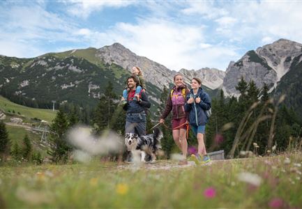
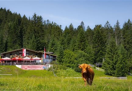
The hike begins at Parking Lot P14 "Katzenkopf" and initially follows the road to the right. After a few meters, the trail turns left into the forest. Here, the well-maintained forest path ascends gently through the woods. Step by step, you make your way through the forest until you reach the Katzenkopfhütte — a cozy hut inviting you to take a break.

For those who prefer an easier ascent, the mountain railway offers a direct route to the Katzenkopf. Additionally, the area features a bike park with various dynamic trails. Beyond the bike park, there are other attractions such as a playground for young adventurers and an exciting disc golf course with multiple holes. This versatile mountain destination offers something for hiking and biking enthusiasts, as well as families.

On good weather days, the “Wildcat” summer toboggan run offers a fun ride from the top to the bottom station – a thrilling highlight for all ages.

A diverse mountain destination with something to offer for hikers, bikers, and families alike.

Features & Characteristics

Start Point

Parking Katzenkopf Leutasch (P14)

End Point

Parking Katzenkopf Leutasch (P14)

Family-friendly

Yes
Similar Tour Suggestions

Pfarrhuegel-in-Seefeld_WaLogo.jpg

Hiking

Village tour Pfarrhügel, Wildsee & Seekirchl

Length

4,70 km

Duration

01:30 h

Uphill

48 hm

Altitude

1208 hm

Difficulty

Easy

Höhenweg Leutasch_Aussichtsplattform Höhenweg_Pfarrkirche St. Magdalena und Ganghofermuseum.jpg

Hiking

Wheelchair Circular Hike Runst-Achweg

Length

6,30 km

Duration

02:00 h

Uphill

40 hm

Altitude

1130 hm

Difficulty

Easy

Wanderung zur Scharnitzer Alm - Scharnitzer Alm mit Tannenzweigen im Vordergrund.jpg

Hiking

Circular hiking trail Scharnitzer alpine hut

Length

5,70 km

Duration

01:30 h

Uphill

130 hm

Altitude

1022 hm

Difficulty

Easy

Familie in der Region Seefeld - Leutascher Ache.jpg

Hiking

Hike along the Achweg

Length

10,80 km

Duration

03:00 h

Uphill

70 hm

Downhill

78 hm

Altitude

1170 hm

Difficulty

Easy

Partially open
wildsee_im_sommer_drohnenaufnahme_bei_morgenstimmung_275882015.jpg

Hiking

Wheelchair Circular Hike around the Wildsee

Length

3,40 km

Duration

01:00 h

Altitude

1180 hm

Difficulty

Easy

drohnenfoto_von_neuleutasch_mit_blick_richtung_leutasch_221264322.jpg

Hiking

Hike from Leutasch to Seefeld

Length

4,60 km

Duration

01:30 h

Uphill

118 hm

Downhill

83 hm

Altitude

1225 hm

Difficulty

Easy

Reith - Wanderung Frau Häusl Kapelle - Bank und Bildstock mit Aussicht ins Inntal.jpg

Hiking

Circular hike panoramic path

Length

6,70 km

Duration

02:15 h

Uphill

289 hm

Altitude

1306 hm

Difficulty

Easy

Herbstwanderung am Oberen Wiesenweg_Paar läuft entlang von Wiese_Aufnahme gegen die Sonne mit Lärchen im Hintergrund.jpg

Hiking

Circular hiking traill Oberer & Unterer Wiesenweg

Length

6,10 km

Duration

02:00 h

Uphill

64 hm

Altitude

1194 hm

Difficulty

Easy