We use cookies for your personalized browsing experience, to personalize content and ads, to provide social media features, and to analyze traffic to our website. We also share information about your use of our website with our social media, advertising and analytics partners. Our partners may combine this information with other data that you have provided to them or that they have collected as part of your use of the Services. (incl. US providers)

Start Point

Seefeld Römerweg (bottom station Rosshütte)

End Point

Scharnitz
Difficulty

Easy

Total Distance

9,60 km

Descent Meters

27 m

Ascent Meters

288 m

Highest Point

1252 m

Total Time

02:30 h

Status

Closed

Map & Elevation Profile

Start Point

Seefeld Römerweg (bottom station Rosshütte)

End Point

Scharnitz
Difficulty

Easy

Total Distance

9,60 km

Descent Meters

27 m

Ascent Meters

288 m

Highest Point

1252 m

Total Time

02:30 h

Status

Closed

Hiking

Best Time

Closed

Jan

Feb

Mar

Apr

May

Jun

Jul

Aug

Sep

Oct

Nov

Dec

Hiking tour

Village walks

+1

Attention: The Schlagstein (Path no. 70) between Seefeld and Scharnitz is currently completely closed due to a mudslide.

Route: Seefeld / Römerweg (Rosshütte valley station) - Giessenbach - Scharnitz

Parking and public transport:

P19 "Car park of the Rosshütte cable cars".

By train to Seefeld train station (15 minutes walk to the starting point).

You can find all connections in real time with the Mobility-App "wegfinder".

Directions:

On the Römerweg, which joins the Hirnweg at Schlossberg, leave Seefeld in a northerly direction. At the end of the Hirnweg turn right over the bridge. Immediately after the bridge begins a trail that leads next to the railroad past the Mühlberg to Scharnitz. By train (departures once an hour) back to the starting point.

Alpine emergency call:

Call: 140

Features & Characteristics

Start Point

Seefeld Römerweg (bottom station Rosshütte)

End Point

Scharnitz
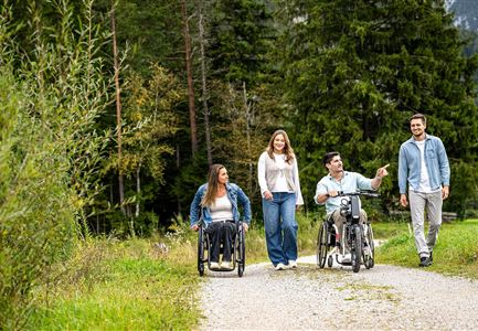
Family hike

Yes

Similar Tour Suggestions

Kaiser Maximilian Weg um den Wildsee - Seefeld

Hiking

Way of imperator Maximilian

Length

2,50 km

Duration

00:30 h

Uphill

3 hm

Altitude

1180 hm

Difficulty

Easy

Katzenloch Leutasch

Hiking

Hike through the Katzenloch

Length

7,10 km

Duration

01:30 h

Uphill

150 hm

Altitude

1280 hm

Difficulty

Easy

Wanderweg führt an der Gleirschklamm entlang.jpg

Hiking

Circular hiking trail Gleirschklamm

Length

13,10 km

Duration

04:00 h

Uphill

381 hm

Altitude

1152 hm

Difficulty

Medium

Wildmoosalm im Sommer

Hiking

Hike Schlagweg-Rauthgatter-Wildmoos

Length

11,50 km

Duration

03:30 h

Uphill

220 hm

Altitude

1345 hm

Difficulty

Easy

Scharnitz_Gießenbach_Eppzirl.jpg

Hiking

Circular village walk Scharnitz - Gießenbach

Length

6,10 km

Duration

01:30 h

Uphill

42 hm

Altitude

1013 hm

Difficulty

Easy

Seefeld Reith 2022 Sommer Wanderung Noerdlinger Huette Reither Spitze Seefelder Spitze Seefelder Joch Panorama Hochplateau

Hiking

Circular hike to the Nördlinger Hütte alpine hut & Reither Spitze Summit, 2,374m

Length

9,10 km

Duration

07:30 h

Uphill

1161 hm

Altitude

2374 hm

Difficulty

Hard

Isarursprung im Karwendel - Scharnitz

Hiking

Bike & Hike Halleranger house - Halleranger alm

Length

38,00 km

Duration

06:00 h

Uphill

832 hm

Altitude

1768 hm

Difficulty

Medium

Radtour ins Gaistal - Bruecke am Eingang vom Gaistal

Hiking

Bike & Hike lake Seebensee & lake Drachensee

Length

31,00 km

Duration

04:45 h

Uphill

820 hm

Downhill

815 hm

Altitude

1897 hm

Difficulty

Medium