Start Point

Music Pavilion Weidach (P15)

End Point

Music Pavilion Weidach (P15)

Difficulty

Easy

Total Distance

5,00 km

Descent Meters

50 m

Ascent Meters

50 m

Highest Point

1160 m

Total Time

01:30 h

Map & Elevation Profile

Start Point

Music Pavilion Weidach (P15)

End Point

Music Pavilion Weidach (P15)

Difficulty

Easy

Total Distance

5,00 km

Descent Meters

50 m

Ascent Meters

50 m

Highest Point

1160 m

Total Time

01:30 h

Hiking

Best Time

Jan

Feb

Mar

Apr

May

Jun

Jul

Aug

Sep

Oct

Nov

Dec

Hiking tour

Village walks

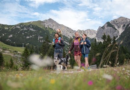
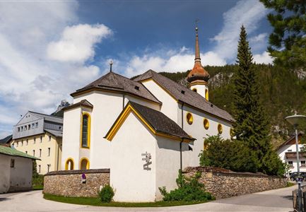
The starting point of the hike is located at the music pavilion, where ample parking is available. From there, the trail first follows the road, keeping slightly left, until you reach the Katzner Chapel. At the Weidach Quellenhof bus stop, turn left to arrive directly at the idyllic Weidachsee.

This lake is a fishing lake where anyone can fish for a small fee – even without a fishing license. Passing the lake café with its fishery – a particularly tempting spot for a break – the route continues along the lake promenade.

At the southern shore, the trail leads into the forest, forming a small loop. At the junction, keep left towards Kirchplatzl. From here, you reach the Leutascher Ache, a river that runs through the entire 16-kilometer-long valley and is a charming companion in every season – also perfectly suited for walks with a stroller.

Follow the river downstream until you arrive at a junction in the district of Weidach, with the Norz sports shop on the corner. Turn right here and stroll comfortably along the sidewalk through the village back to the starting point

Similar Tour Suggestions

Lottensee im Frühsommer - See und Hütte.jpg

Hiking

Circular hike to the Wildmossalm alpine hut & Lottenseehütte alpine hut

Length

7,10 km

Duration

02:30 h

Uphill

250 hm

Altitude

1420 hm

Difficulty

Easy

Spaziergang mit Hund in Unterleutasch - Mann läuft mit Hund entlang von Bäumen Aufnahme Richtung Sonne.jpg

Hiking

Tour of lawn "toler"

Length

4,20 km

Duration

00:45 h

Uphill

13 hm

Altitude

1072 hm

Difficulty

Easy

Herbst am Möserer See - Frau am Ufer (Edit 2).jpg

Hiking

Circular walking path lake Möserer See & Kalvarienberg

Length

3,00 km

Duration

01:00 h

Uphill

78 hm

Downhill

82 hm

Altitude

1291 hm

Difficulty

Easy

Wettersteingebirge und Leutasch im Sommer - Drohnenaufnahme von der Muggenmoosalm.jpg

Hiking

Hike Schlagweg-Rauthgatter-Wildmoos

Length

11,50 km

Duration

03:30 h

Uphill

220 hm

Altitude

1345 hm

Difficulty

Easy

Katzenkopfhuette Leutasch (2).jpg

Hiking

Hike to the Katzenkopfhütte alpine hut

Length

5,20 km

Duration

02:00 h

Uphill

243 hm

Altitude

1360 hm

Difficulty

Easy

Möserer See im Frühling - Paar läuft entlang des Seeweges.jpg

Hiking

Circular walking path from Seefeld to the lake Möserer See

Length

8,80 km

Duration

02:30 h

Uphill

231 hm

Altitude

1297 hm

Difficulty

Easy

Scharnitz - Wanderung Dorfrunde - Kirche in Scharnitz.jpg

Hiking

Scharnitz cultural hiking trail

Length

3,00 km

Duration

01:00 h

Uphill

53 hm

Altitude

1005 hm

Difficulty

Easy

Höhenweg Leutasch_Aussichtsplattform Höhenweg_Pfarrkirche St. Magdalena und Ganghofermuseum.jpg

Hiking

Wheelchair Circular Hike Runst-Achweg

Length

6,30 km

Duration

02:00 h

Uphill

40 hm

Altitude

1130 hm

Difficulty

Easy