Start Point

Scharnitz Parking P1 "Ried"

End Point

Scharnitz Parking P1 "Ried"

Difficulty

Easy

Total Distance

3,00 km

Descent Meters

53 m

Ascent Meters

53 m

Highest Point

1005 m

Total Time

01:00 h

Map & Elevation Profile

Start Point

Scharnitz Parking P1 "Ried"

End Point

Scharnitz Parking P1 "Ried"

Difficulty

Easy

Total Distance

3,00 km

Descent Meters

53 m

Ascent Meters

53 m

Highest Point

1005 m

Total Time

01:00 h

Hiking

Best Time

Jan

Feb

Mar

Apr

May

Jun

Jul

Aug

Sep

Oct

Nov

Dec

Thematic route

Village walks

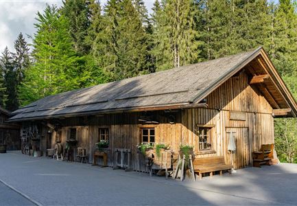
The cultural hiking trail leads through the historic townscape of Scharnitz without any significant inclines but with many highlights worth seeing. Along the way, you will come across the "Karwendel Treaty", the Porta Claudia Alpine fortress, the old corn mill, the Way of the Cross on the Kalvarienberg, the first Tyrolean Isar bridge and the Goldener Adler inn, which is over 300 years old.

Similar Tour Suggestions

Fischerrei am Weidachsee - Leutasch (1)(1).jpg

Hiking

Circular walk around Weidachsee lake

Length

3,80 km

Duration

01:00 h

Uphill

46 hm

Altitude

1156 hm

Difficulty

Easy

Scharnitz - Wanderung zur Adlerkanzel - Blick auf die Isar.jpg

Hiking

Circular village walk Scharnitz - Gießenbach

Length

6,10 km

Duration

01:30 h

Uphill

42 hm

Altitude

1013 hm

Difficulty

Easy

Reith Wiesenweg im Frühling - Drohnenaufnahme strahlend grüne Wiese mit Blick zum Inntal.jpg

Hiking

Circular hiking traill Wiesenweg

Length

4,60 km

Duration

01:30 h

Uphill

109 hm

Altitude

1128 hm

Difficulty

Easy

Drohnenfoto von Neuleutasch mit Blick Richtung Leutasch.jpg

Hiking

Hike from Leutasch to Seefeld

Length

4,60 km

Duration

01:30 h

Uphill

118 hm

Downhill

83 hm

Altitude

1225 hm

Difficulty

Easy

Bienenlehrpfad Reith - Infotafel am Bienenhotel (1).jpg

Hiking

Hike Bee Nature Trail

Length

2,50 km

Duration

01:00 h

Uphill

72 hm

Altitude

1185 hm

Difficulty

Easy

kinder_bei_infotafel_in_der_geisterklamm.jpg

Hiking

Short circular trail at the Spirit Gorge

Length

500 m

Duration

00:15 h

Uphill

10 hm

Altitude

1027 hm

Difficulty

Easy

Porta Claudia Scharnitz - Tor mit Weg.jpg

Hiking

Circular hiking trail Porta Claudia

Length

2,50 km

Duration

01:00 h

Uphill

125 hm

Downhill

120 hm

Altitude

1085 hm

Difficulty

Easy

Pfarrhuegel-in-Seefeld_WaLogo.jpg

Hiking

Village tour Pfarrhügel, Wildsee & Seekirchl

Length

4,70 km

Duration

01:30 h

Uphill

48 hm

Altitude

1208 hm

Difficulty

Easy