Start Point

Information office Seefeld
End Point

Seefeld-Rosshütte Top Station

Difficulty

Hard

Total Distance

10,80 km

Descent Meters

570 m

Ascent Meters

5 m

Highest Point

1751 m

Total Time

01:20 h

Map & Elevation Profile

Start Point

Information office Seefeld
End Point

Seefeld-Rosshütte Top Station

Difficulty

Hard

Total Distance

10,80 km

Descent Meters

570 m

Ascent Meters

5 m

Highest Point

1751 m

Total Time

01:20 h

Cycling

Best Time

Jan

Feb

Mar

Apr

May

Jun

Jul

Aug

Sep

Oct

Nov

Dec

Mountainbike tour

Bike tour to the Rosshütte

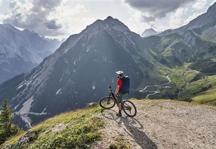
From the information office in Seefeld / train station Seefeld in northern direction turn right, via the car park until you cross the railway tracks, turn right here in eastern direction and follow Andreas-Hofer-Straße slightly uphill until you reach the roundabout. At the roundabout take the second exit and immediately turn right over the pedestrian bridge to the Rosshütte cable car valley station. From here, take a steep gravel road towards north-east. At the crossroads, keep left at the chairlift and follow the forest road. The first flat stretch and thus a short breather is at the Hocheggalm. This flat stretch only lasts for a short time, then it goes steeply uphill again from the Kaltwassersee lake to the Rosshütte mountain station. To get back to the starting point / parking lot, take the same way back, please take special care on the downhill rides in the steep section.s

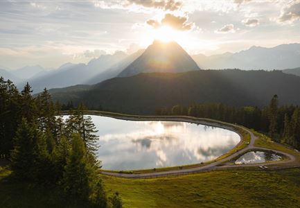
Tip: The lake Kaltwassersee is the optimal photopoint and should not be missed. You can strengthen yourself in the mountain restaurant Rosshütte which offers a large selection of dishes.

Attention pasture cattle, please keep distance and cross the pasture area calmly and quickly.

Features & Characteristics

Start Point

Information office Seefeld

End Point

Seefeld-Rosshütte Top Station

Similar Tour Suggestions

Triendlweg-Bauernwald Gasthaus Triendlsäge (c) Anna Rieder

Cycling

Biketour No. 535 Triendlweg-Bauernwald

Length

8,60 km

Duration

01:10 h

Uphill

217 hm

Altitude

1220 hm

Difficulty

Medium

Gravelbiker in Scharnitz im Sommer

Cycling

Bike-connection No. 5051 Seefeld-Scharnitz

Length

25,30 km

Duration

01:15 h

Uphill

256 hm

Downhill

250 hm

Altitude

1195 hm

Difficulty

Medium

Radfahrerinnen auf dem Weg zur Gaistalalm - 01.jpg

Cycling

Gravelbiketour Gaistal

Duration

01:45 h

Uphill

353 hm

Downhill

194 hm

Altitude

1363 hm

Difficulty

Medium

Reitherjoch-Alm (c) Anna Rieder

Cycling

Biketour No. 5032 Reitherjoch Alm

Length

12,60 km

Duration

02:00 h

Uphill

372 hm

Downhill

368 hm

Altitude

1495 hm

Difficulty

Medium

Leutascher Ache im Sommer mit Blick auf die Hohe Munde - Weidach - 1350x1080.jpg

Cycling

Biketour Arnspitzrunde

Length

33,10 km

Duration

03:30 h

Uphill

377 hm

Altitude

1220 hm

Difficulty

Medium

Möserer See im Frühling - Paar auf Liege vor Möserer Seestube von aus der Entfernung.jpg

Cycling

Biketour Seefeld - Mösern - Wildmoos - Katzenkopf - Fludertal - Seefeld

Length

27,20 km

Duration

04:00 h

Uphill

657 hm

Downhill

651 hm

Altitude

1368 hm

Difficulty

Medium

Seebensee mit Raeder im Vordergrund

Cycling

Biketour No. 551 Seebensee

Length

27,60 km

Duration

01:40 h

Uphill

561 hm

Downhill

557 hm

Altitude

1581 hm

Difficulty

Medium

Reith-Wiesenwegrunde (c) Anna Rieder

Cycling

Biketour No. 5031 Reith-Wiesenweg

Length

4,60 km

Duration

00:35 h

Uphill

109 hm

Downhill

110 hm

Altitude

1129 hm

Difficulty

Medium