We use cookies for your personalized browsing experience, to personalize content and ads, to provide social media features, and to analyze traffic to our website. We also share information about your use of our website with our social media, advertising and analytics partners. Our partners may combine this information with other data that you have provided to them or that they have collected as part of your use of the Services. (incl. US providers)

Start Point

Mösern Information Office

End Point

Mösern Information Office

Difficulty

Easy

Total Distance

3,00 km

Descent Meters

78 m

Ascent Meters

82 m

Highest Point

1291 m

Total Time

01:00 h

Map & Elevation Profile

Start Point

Mösern Information Office

End Point

Mösern Information Office

Difficulty

Easy

Total Distance

3,00 km

Descent Meters

78 m

Ascent Meters

82 m

Highest Point

1291 m

Total Time

01:00 h

Hiking

Best Time

Jan

Feb

Mar

Apr

May

Jun

Jul

Aug

Sep

Oct

Nov

Dec

Hiking tour

Village walks

+3

Route: Mösern Information Office - Heimatmuseum in Sterzingerhof - Kalvarienberg - Möserer See - Möserer Seestub'n - Peace Bell - Heimatmuseum in Sterzingerhof - Mösern Information Office

Public transport:
Take the train to Seefeld station and continue with the Regio-/Skibus to the stop "Mösern Kirche".
Find all connections in real time with the Mobility-App "wegfinder".

Directions:
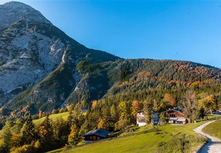
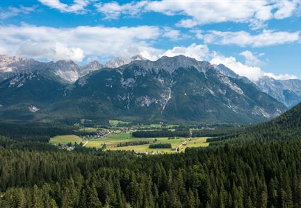
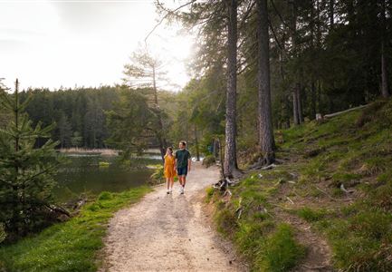
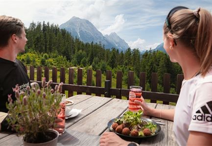
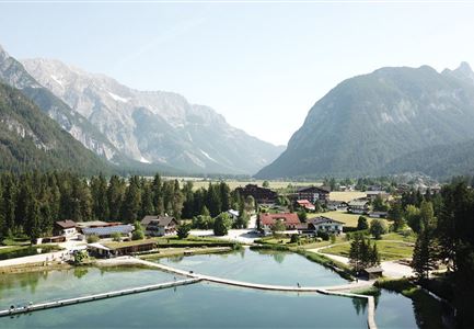
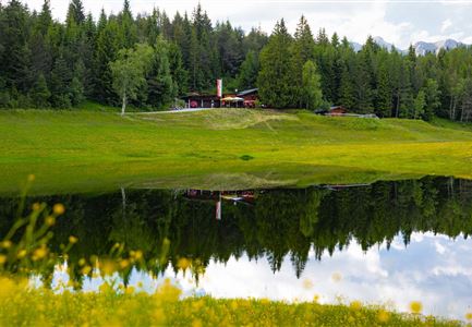
The tour starts at the Mösern Information Office and passes by the Heimatmuseum at the Sterzingerhof, leading over the Kalvarienberg to the idyllic Möserer See. This lake, nestled in the landscape of the Seefeld High Plateau, is often adorned with rare water lilies. At Möserer See, the Möserer Seestub’n restaurant invites visitors to relax and enjoy regional delicacies. The path then continues to the largest free-standing Peace Bell in the Alpine region, offering a stunning view of the Inn Valley and the surrounding mountains. From there, the route leads back to the starting point.

Alpine emergency call:
Call: 140

Features & Characteristics

Start Point

Mösern Information Office

End Point

Mösern Information Office

Family-friendly

Yes

Loop tour

Yes

Similar Tour Suggestions

Wandern zum Gasthof Brücke

Hiking

Tour of lawn "toler"

Length

4,20 km

Duration

00:45 h

Uphill

13 hm

Altitude

1072 hm

Difficulty

Easy

Wildmoosalm im Sommer - Alm aus der Distanz mit Gewässer im Vordergrund.jpg

Hiking

Circular hiking trail Wildmoos-Hochmoos

Length

10,00 km

Duration

04:00 h

Uphill

437 hm

Altitude

1544 hm

Difficulty

Medium

Karwendelmarsch 2018 (13).jpg

Hiking

Karwendel March 35 km

Length

35,00 km

Duration

12:30 h

Uphill

1664 hm

Downhill

1358 hm

Altitude

1843 hm

Difficulty

Hard

Wanderung zur Eppzirler Alm im Sommer - Mann und Frau von hinten mit Eppzirler Alm.jpg

Hiking

Circular hike via Eppzirler Alm and Nördlinger hut to Seefeld

Length

20,40 km

Duration

10:00 h

Uphill

1464 hm

Altitude

2231 hm

Difficulty

Hard

Wanderung auf die Birkkarspitze - Scharnitz (65).jpg

Hiking

Hike from the Karwendelhaus to the Hinterautal

Length

9,20 km

Duration

07:00 h

Uphill

883 hm

Altitude

2642 hm

Difficulty

Hard

Pleisenhütte im Sommer - Scharnitz - quer.jpg

Hiking

Hike to the Pleisen alpine hut

Length

15,90 km

Duration

05:00 h

Uphill

780 hm

Downhill

774 hm

Altitude

1753 hm

Difficulty

Medium

Falkenhütte neu

Hiking

Karwendelmarsch 52 km

Length

52,00 km

Duration

19:00 h

Uphill

2281 hm

Downhill

2217 hm

Altitude

1903 hm

Difficulty

Hard

Fischerrei am Weidachsee - Leutasch

Hiking

Circular walk around Weidachsee lake

Length

3,80 km

Duration

01:00 h

Uphill

46 hm

Altitude

1156 hm

Difficulty

Easy