We use cookies for your personalized browsing experience, to personalize content and ads, to provide social media features, and to analyze traffic to our website. We also share information about your use of our website with our social media, advertising and analytics partners. Our partners may combine this information with other data that you have provided to them or that they have collected as part of your use of the Services. (incl. US providers)

Start Point

Leutasch

End Point

Leutasch

Difficulty

Easy

Total Distance

7,10 km

Descent Meters

150 m

Highest Point

1280 m

Total Time

01:30 h

Map & Elevation Profile

Start Point

Leutasch

End Point

Leutasch

Difficulty

Easy

Total Distance

7,10 km

Descent Meters

150 m

Highest Point

1280 m

Total Time

01:30 h

Hiking

Best Time

Jan

Feb

Mar

Apr

May

Jun

Jul

Aug

Sep

Oct

Nov

Dec

Hiking tour

Family-friendly

+2

Route: Leutasch / Moos - Katzenloch - Buchen - Schlagweg - Moos

Parking and public transport:

P11 "Parking Rödlach"

By train to Seefeld station and continue with the Regiobus to the stop "Leutasch Moos/Rödlach".

You can find all connections in real time with the Mobility-App "wegfinder".

Directions:

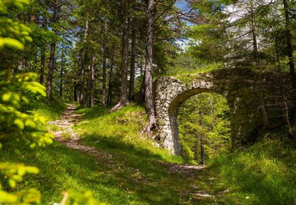
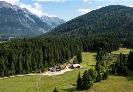
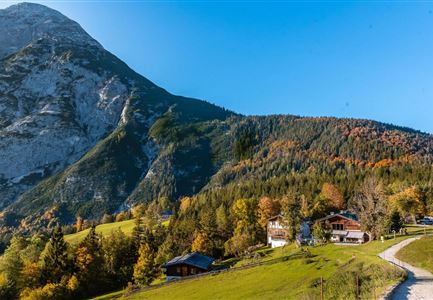
A slight ascent begins at Haus Isabella in Moos and continues through Katzenloch to Ropferstub'm. From there, take the small climb to the Buchener Höhe, continue via the Schlagweg back to Moos. Alternative only in summer: 50 m after the road junction to the Munde parking lot, turn left and follow the path slightly uphill through the Rappental valley to the junction with the Katzenlochweg.

Alpine emergency call:

Call: 140

Features & Characteristics

Start Point

Leutasch

End Point

Leutasch

Family-friendly

Yes

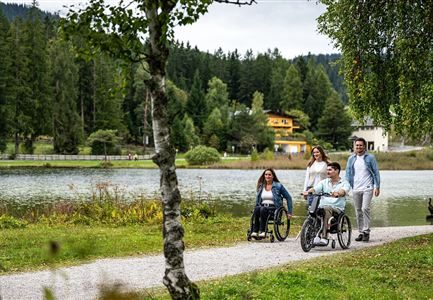
Stroller-friendly

Yes

Loop tour

Yes

Similar Tour Suggestions

Scharnitz - Wanderung Dorfrunde - Weg durch den Wald mit blühenden Bäumen.jpg

Hiking

Hike from Seefeld to Scharnitz

Length

9,60 km

Duration

02:30 h

Uphill

27 hm

Downhill

288 hm

Altitude

1252 hm

Difficulty

Easy

Partially open
Wildmoosalm im Sommer - Hütte mit Kuh.jpg

Hiking

Hike to the Wildmoosalm alpine hut

Length

5,80 km

Duration

01:45 h

Uphill

131 hm

Altitude

1305 hm

Difficulty

Easy

Scharnitz - Wanderung zur Birzlkapelle - Kapelle mit Pausenbank.jpg

Hiking

Hike to the Birzlkapelle chapel

Length

4,60 km

Duration

01:30 h

Uphill

156 hm

Altitude

1131 hm

Difficulty

Easy

Wanderung über der Karwendelschlucht - Scharnitz.jpg

Hiking

Circular hiking trail Karwendelschlucht/Karwendelsteg

Length

7,40 km

Duration

03:00 h

Uphill

266 hm

Altitude

1143 hm

Difficulty

Medium

Drohnenaufnahme Aussichtsplattform auf dem Brunschkopf - Aufnahme bei Abenddämmerung mit Paar auf Plattform.jpg

Hiking

Viewpoint Brunschkopf via Möserer Höhe

Length

8,70 km

Duration

03:00 h

Uphill

311 hm

Downhill

314 hm

Altitude

1499 hm

Difficulty

Medium

Muggenmoosalm

Hiking

Circular hike from Seefeld to the Lottenseehütte alpine hut & Muggenmoosalm alpine hut

Length

15,30 km

Duration

04:30 h

Uphill

554 hm

Altitude

1398 hm

Difficulty

Easy

Spaziergang rund um den Moeserer See im Sommer

Hiking

Circular walking path from Seefeld to the lake Möserer See

Length

8,80 km

Duration

02:30 h

Uphill

231 hm

Altitude

1297 hm

Difficulty

Easy

Gravelbike - Zum Isarursprung.jpg

Hiking

Bike & Hike Hoher Gleirsch Summit, 2,492 m

Length

31,00 km

Duration

09:30 h

Uphill

1772 hm

Altitude

2492 hm

Difficulty

Hard