Start Point

Solsteinhaus

End Point

Pfeishütte

Difficulty

Hard

Total Distance

12,74 km

Descent Meters

1150 m

Ascent Meters

1400 m

Highest Point

2314 m

Total Time

07:00 h

Map & Elevation Profile

Start Point

Solsteinhaus

End Point

Pfeishütte

Difficulty

Hard

Total Distance

12,74 km

Descent Meters

1150 m

Ascent Meters

1400 m

Highest Point

2314 m

Total Time

07:00 h

Hiking

Best Time

Jan

Feb

Mar

Apr

May

Jun

Jul

Aug

Sep

Oct

Nov

Dec

Hiking tour

Multi-Day Tour Feature: Etappe

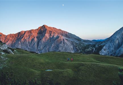
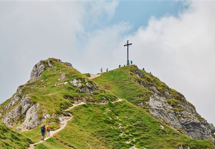
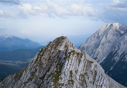
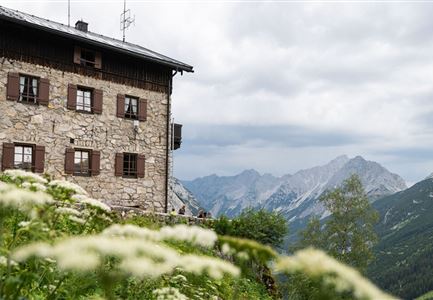
The third stage of the Karwendel High Trail leads from the Solsteinhaus down along Trail 213 toward Möslalm. When the trail junction at the ‘Wilde Iss’, take the Gipfelstürmerweg trail (215) eastwards and head past the Wilde-Iss-Jagdhütte hut. The trail snakes along a green ridge featuring trees and mountain pines as it leads you up to the ‘Hippen’ peak. After a brief descent, you are then faced with a very steep ascent along passages secured with ropes that bring you to the Frau Hitt ridge. This is located to the west of the prominent Frau Hitt rock needle. CAUTION: even in early summer, the Frau Hitt cirque may feature a very large amount of old snow that remains icy into the morning (risk of falling: Snowline Spikes and sticks provide optimum protection). Legend has it that the rock needle represents a woman on a horse. The descent from the Frau Hitt ridge starts out very steep and subsequently follows the Schmidhubersteig trail, crossing picturesque mountain pastures on the way to the Seegrube restaurant (1906 m). After a refreshing break at the Seegrube, you take trail 216 as it makes a steep ascent

Features & Characteristics

Start Point

Solsteinhaus

End Point

Pfeishütte

Multi-Day Tour Feature

Etappe

Similar Tour Suggestions

Wanderguppe auf dem Gipfel der Gehrenspitze oberhalb von Leutasch

Hiking

Bike & Hike Gehrenspitze Summit, 2,367 m

Length

21,00 km

Duration

07:00 h

Uphill

1150 hm

Altitude

2367 hm

Difficulty

Hard

Sonnenaufgang im Karwendel_Speckkarspitze

Hiking

Bike & Hike Speckkarspitze, 2,621 m

Length

44,00 km

Duration

11:00 h

Uphill

1794 hm

Altitude

2621 hm

Difficulty

Hard

Wanderer auf dem Weg vom Seefelder Joch zur Seefelder Spitze - Gipfelkreuz der Spitze im Blick.jpg

Hiking

"Königstour" The royal's hiking tour

Length

4,40 km

Duration

03:00 h

Uphill

502 hm

Downhill

464 hm

Altitude

2364 hm

Difficulty

Hard

Grosse Arnspitze Blick ins Karwendel - Scharnitz

Hiking

Hike Hoher Sattel - Große Arnspitze Summit, 2,196 m

Length

10,30 km

Duration

08:00 h

Uphill

1313 hm

Altitude

2196 hm

Difficulty

Hard

Meilerhütte

Hiking

Hike to the Meilerhütte alpine hut

Length

16,90 km

Duration

09:00 h

Uphill

1390 hm

Altitude

2371 hm

Difficulty

Hard

Solsteinhaus Etappe 2 Ziel & 3 Start

Hiking

Hike to the Solsteinhaus

Length

22,00 km

Duration

08:00 h

Uphill

940 hm

Downhill

975 hm

Altitude

1803 hm

Difficulty

Hard

Partially open
Wanderer auf dem Predigtstuhl.jpg

Hiking

Bike & Hike Predigtstuhl Summit, 2,234 m

Length

19,00 km

Duration

04:30 h

Uphill

1015 hm

Altitude

2234 hm

Difficulty

Hard

Durchs Karwendeltal aufs Karwendelhaus - Scharnitz

Hiking

Hike to the Karwendelhaus

Length

36,00 km

Duration

11:15 h

Uphill

839 hm

Altitude

1765 hm

Difficulty

Hard