We use cookies for your personalized browsing experience, to personalize content and ads, to provide social media features, and to analyze traffic to our website. We also share information about your use of our website with our social media, advertising and analytics partners. Our partners may combine this information with other data that you have provided to them or that they have collected as part of your use of the Services. (incl. US providers)

Start Point

Leutasch Oberweidach

End Point

Leutasch Katzenkopfhütte
Difficulty

Medium

Total Distance

2,60 km

Descent Meters

245 m

Highest Point

1357 m

Total Time

01:15 h

Map & Elevation Profile

Start Point

Leutasch Oberweidach

End Point

Leutasch Katzenkopfhütte
Difficulty

Medium

Total Distance

2,60 km

Descent Meters

245 m

Highest Point

1357 m

Total Time

01:15 h

Hiking

Best Time

Jan

Feb

Mar

Apr

May

Jun

Jul

Aug

Sep

Oct

Nov

Dec

Winter walking

EXTENSION • SECTION 1 or 4

UP THE MOUNTAIN KATZENKOPF (2,5 KM)


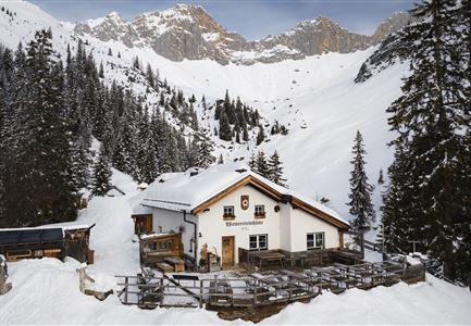
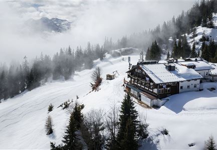
In good weather, a trip to the Katzenkopf panoramic viewpoint (trail no. 34 from Seewald) is highly recommended. At the top you will be rewarded with a breathtaking panoramic view and regional delicacies in the Katzenkopfhütte (1349m). For a bit of action at the end, you can rent a toboggan (sled) in advance at the valley station and finally enjoy a good fifteen minutes slide into the valley.

If you prefer to save your strength for the next few days, you can choose the comfortable uphill ride with the Katzenkopf lift.

REFRESHMENT STOPS ALONG THE WAY:

Kreithalm

Katzenkopf hut

HIGHLIGHTS AND VIEWPOINTS

• Katzenkopf

Accessible on foot via the paved trail no. 34 or with the Kreithlift mountain railroad.


Lift operation Mon-Sun: 9a.m. to 4p.m.

Mountain ride: € 9,00 per person

Features & Characteristics

Start Point

Leutasch Oberweidach

End Point

Leutasch Katzenkopfhütte
Similar Tour Suggestions

Gaistalalm im Winter - Luftaufnahme.jpg

Hiking

W12: Winter hike to the Gaistalalm

Length

8,22 km

Duration

02:45 h

Uphill

150 hm

Altitude

1404 hm

Difficulty

Easy

Winterlandschaft in Leithen bei Reith

Hiking

W33: Winter circular hike Hölltal

Length

5,00 km

Duration

02:15 h

Uphill

193 hm

Altitude

1303 hm

Difficulty

Medium

Winterwandern - Winterwanderweg rund um den Brunschkopf - Weitwanderweg

Hiking

W3: Winter circular hike Seefeld-Mösern-Seefeld

Length

7,80 km

Duration

02:30 h

Uphill

183 hm

Downhill

179 hm

Altitude

1374 hm

Difficulty

Medium

Wiesenwegrunde

Hiking

W17: Winter circular hike on the Wiesenweg

Length

6,20 km

Duration

01:45 h

Uphill

61 hm

Altitude

1193 hm

Difficulty

Easy

Katzenkopf Leutasch

Hiking

W20: Winter hike to the Katzenkopfhütte

Length

5,10 km

Duration

02:15 h

Uphill

231 hm

Altitude

1353 hm

Difficulty

Easy

Winterwanderweg - Neuleutasch

Hiking

W16: Winter hike from Leutasch to Seefeld

Length

6,60 km

Duration

02:15 h

Uphill

164 hm

Altitude

1225 hm

Difficulty

Easy

Winterwandern Paar Möserer See Paar läuft durch Wald Aufnahme von hinten (1).jpg

Hiking

W1: Winter circular hike Seefeld-Mösern-Wildmoos

Length

13,00 km

Duration

03:30 h

Uphill

247 hm

Altitude

1333 hm

Difficulty

Medium

Open
W34 Kulturwanderweg Reith Unsere Frau Winter - Leithen

Hiking

W34: Winter circular hike "culture path" Reith

Length

4,50 km

Duration

01:30 h

Uphill

112 hm

Altitude

1126 hm

Difficulty

Easy