Start Point

Pleisenhütte

End Point

Karwendelhaus
Difficulty

Hard

Total Distance

12,74 km

Descent Meters

1200 m

Ascent Meters

1200 m

Highest Point

2506 m

Total Time

08:00 h

Map & Elevation Profile

Start Point

Pleisenhütte

End Point

Karwendelhaus
Difficulty

Hard

Total Distance

12,74 km

Descent Meters

1200 m

Ascent Meters

1200 m

Highest Point

2506 m

Total Time

08:00 h

Hiking

Best Time

Jan

Feb

Mar

Apr

May

Jun

Jul

Aug

Sep

Oct

Nov

Dec

Hiking tour

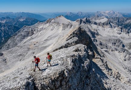
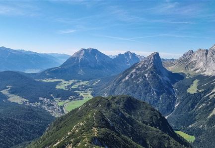
A little-traveled route in high alpine terrain, suitable only for very experienced mountaineers.

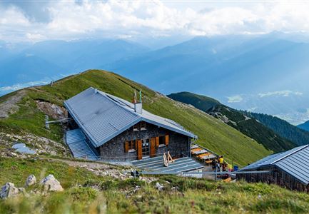
From the Pleisenhütte, follow the trail toward the Pleisenspitze for about 20 minutes, then turn right at the signpost onto the Toni Gaugg Ridge Trail. The route continues uphill through dwarf pines and heads east past the base of massive limestone slabs (memorial plaque) into the Mitterkar. The path then climbs – again through dwarf pines – to the base of the long southern ridge of the Larchetkarspitze, eventually crossing over to the eastern side of the ridge beneath overhanging yellow-grey rock walls.

Here, a traverse known as the Kuchl marks the first key section of the trail – and is a good indicator for what's to come. Anyone struggling here is strongly advised to turn back. After the traverse, the path descends slightly, then curves left around a ridge and enters a scree gully equipped with new steel cables for descent. Follow this gully pathlessly for about 60 m across a boulder field, then continue left along the now-visible trail into the Hinterkar.

Through the Hinterkar – now completely beyond the belt of dwarf pines – the path gently ascends toward the base of the southern ridge

Features & Characteristics

Start Point

Pleisenhütte

End Point

Karwendelhaus

Similar Tour Suggestions

Falkenhütte neu

Hiking

Karwendelmarsch 52 km

Length

52,00 km

Duration

19:00 h

Uphill

2281 hm

Downhill

2217 hm

Altitude

1903 hm

Difficulty

Hard

Sonnenuntergang Hohe Munde_Ostgipfel_.jpg

Hiking

Hike Hohe Munde Summit, 2.592 m

Length

11,30 km

Duration

09:00 h

Uphill

1410 hm

Altitude

2562 hm

Difficulty

Hard

Ausblick von der Arnplattenspitze auf die Gehrenspitze, Hohe Munde und Leutasch im Herbst - Leutasch.jpg

Hiking

Circular hike Arnplattenspitze, 2,171 m

Length

8,60 km

Duration

07:00 h

Uphill

1106 hm

Altitude

2171 hm

Difficulty

Hard

Karwendelmarsch 2018 (13).jpg

Hiking

Karwendel March 35 km

Length

35,00 km

Duration

12:30 h

Uphill

1664 hm

Downhill

1358 hm

Altitude

1843 hm

Difficulty

Hard

Nördlinger Hütte - Wanderer kurz vor der Hütte (2).jpg

Hiking

Circular hike to the Nördlinger Hütte alpine hut & Reither Spitze Summit, 2,374m

Length

9,90 km

Duration

07:30 h

Uphill

1191 hm

Altitude

2374 hm

Difficulty

Hard

Drohnenaufnahme Pleisenspitze im Sommer.jpg

Hiking

Hike to the Pleisenspitze Summit, 2,569 m

Length

20,10 km

Duration

10:30 h

Uphill

1600 hm

Altitude

2569 hm

Difficulty

Hard

Wanderer auf der Gehrenspitze ueber Leutasch im Sonnenaufgang - Panoramaaufnahme.jpg

Hiking

Hike to the Gehrenspitze, 2,367 m

Length

22,80 km

Duration

10:00 h

Uphill

1319 hm

Altitude

2367 hm

Difficulty

Hard

Meilerhütte

Hiking

Hike to the Meilerhütte alpine hut

Length

18,90 km

Duration

10:00 h

Uphill

1420 hm

Altitude

2370 hm

Difficulty

Hard