Start Point

Naturpark Info Center Scharnitz (P2)
End Point

Naturpark Info Center Scharnitz (P2)
Difficulty

Easy

Total Distance

12,40 km

Descent Meters

445 m

Ascent Meters

445 m

Highest Point

1250 m

Total Time

04:00 h

Map & Elevation Profile

Start Point

Naturpark Info Center Scharnitz (P2)

End Point

Naturpark Info Center Scharnitz (P2)
Difficulty

Easy

Total Distance

12,40 km

Descent Meters

445 m

Ascent Meters

445 m

Highest Point

1250 m

Total Time

04:00 h

Running

Best Time

Jan

Feb

Mar

Apr

May

Jun

Jul

Aug

Sep

Oct

Nov

Dec

Trailrunning

Important Notice:
The trail through the Gleirschklamm Gorge is currently closed.
A rockfall has destroyed a bridge, making the path impassable for the time being.

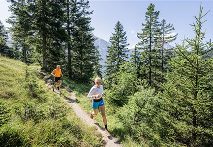
Starting at the Nature Park Information Center in Scharnitz, the route begins with a short paved section before entering the forest. The trail follows the Isarsteig towards Scharnitzer Alm, then turns right into the woods just before reaching the alm.

A short, steep climb leads to a gently ascending natural trail into the Karwendel Valley, running above the Isar. The route then descends into the Gleierschklamm, where a technically demanding trail awaits.

From there, the trail follows the Isar back towards Scharnitzer Alm, near which a Kneipp facility offers a perfect refreshment stop. The return follows the same path back to the starting point.

The indicated running time is just a guideline and depends on your personal fitness level.

Features & Characteristics

Start Point

Naturpark Info Center Scharnitz (P2)

End Point

Naturpark Info Center Scharnitz (P2)
Similar Tour Suggestions

Brunschkopf während der Goldenen Stunde.jpg

Running

Brunschkopf Trailrun Route

Length

11,80 km

Duration

02:30 h

Uphill

334 hm

Downhill

330 hm

Altitude

1499 hm

Difficulty

Easy

Gschwandtkopf Speichersee - Trailrunner in der Distanz läuft entlang des Sees bei Sonnenaufgangsstimmung.jpg

Running

Gschwandtkopf Trailrun Route

Length

9,80 km

Duration

03:30 h

Uphill

430 hm

Altitude

1486 hm

Difficulty

Easy

Trailrunning in der Region Seefeld - Trail durch den Wald.jpg

Running

Trailrun Route around the Hochleithenkopf

Length

16,50 km

Duration

06:00 h

Uphill

760 hm

Altitude

1249 hm

Difficulty

Easy

Lärchenwald bei Reith_Wald mit Sonnenstern.jpg

Running

Around the Gschwandtkopf Trailrun Route

Length

10,30 km

Duration

02:00 h

Uphill

343 hm

Downhill

332 hm

Altitude

1334 hm

Difficulty

Easy

Nordic Summer Camp 2021 - Laeufer bei Laufrunde um den Moeserer See.jpg

Running

Trail Run Loop Möserer See

Length

9,20 km

Duration

02:00 h

Uphill

320 hm

Altitude

1500 hm

Difficulty

Easy

Trailrunning in der Region Seefeld - Läuferinnen auf Trail bergauf - Leutasch.jpg

Running

Gaistal Trailrun loop to Hämmermoosalm, Wettersteinhütte, and Wangalm

Length

10,30 km

Duration

04:00 h

Uphill

520 hm

Altitude

1721 hm

Difficulty

Easy

Trailrunning in der Region Seefeld - Läuferinnen auf Trail im Wald - Gaistal.jpg

Running

Steckenweg Trailrun-Route

Length

13,00 km

Duration

04:30 h

Uphill

480 hm

Altitude

1550 hm

Difficulty

Easy

Trailrunning in der Region Seefeld - Gruppe auf Trail im Wald.jpg

Running

Trail Run Loop Alter Möserer Weg

Length

8,00 km

Duration

03:00 h

Uphill

470 hm

Altitude

1230 hm

Difficulty

Easy