Start Point

Ostbachbrücke Leutasch

End Point

Ostbachbrücke Leutasch

Difficulty

Medium

Total Distance

11,60 km

Descent Meters

223 m

Highest Point

1345 m

Total Time

03:25 h

Status

Open

Map & Elevation Profile

Start Point

Ostbachbrücke Leutasch

End Point

Ostbachbrücke Leutasch

Difficulty

Medium

Total Distance

11,60 km

Descent Meters

223 m

Highest Point

1345 m

Total Time

03:25 h

Status

Open

Hiking

Best Time

Open

Jan

Feb

Mar

Apr

May

Jun

Jul

Aug

Sep

Oct

Nov

Dec

Winter walking

Hut Winter Hikes

This is a cleared winter hiking trail. However, icy or slippery spots may still occur.

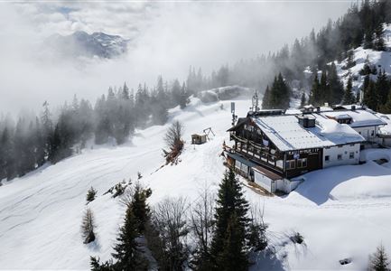
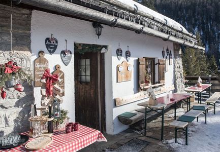
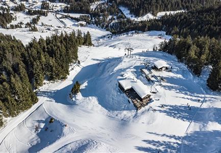
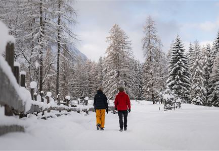
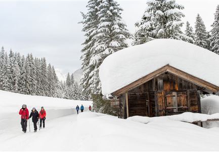
The starting point of the hike is right next to the Ostbach bridge in Leutasch next to the bus stop and from there the trail leads along signposted paths through deep snow-covered woodland to the Muggenmoos Alm (1,252m). On request, the cosy wooden hut on the sun terrace serves small delicacies and refreshments with a mountain view of the Hohe Munde (2,662m). Before you then walk a loop through the winter forests and past the Ferienheim Wildmoos to the Wildmoosalm (1,338m). Here you will find more delicacies, a cosy restaurant and, if required, a horse-drawn carriage back down to the valley.

Features & Characteristics

Start Point

Ostbachbrücke Leutasch

End Point

Ostbachbrücke Leutasch

Family-friendly

Yes
Similar Tour Suggestions

Drohnenbild Gschwandtkopf und Schanze bei Sonneaufgang.jpg

Hiking

W2: Winter Circular Hike around the mountain Gschwandtkopf

Length

10,50 km

Duration

03:30 h

Uphill

226 hm

Downhill

222 hm

Altitude

1342 hm

Difficulty

Medium

Open
Winterwandern im Schnee (1) (3).jpg

Hiking

W21: Winter circular hike Fludertal - Katzenkopf

Length

8,02 km

Duration

02:45 h

Uphill

261 hm

Altitude

1369 hm

Difficulty

Medium

Open
Winterwandern Paar Möserer See Paar läuft durch Wald Aufnahme von hinten (2).jpg

Hiking

W3: Winter Circular Hike Seefeld-Mösern-Seefeld

Length

7,80 km

Duration

02:30 h

Uphill

183 hm

Downhill

179 hm

Altitude

1374 hm

Difficulty

Medium

Open
Winterwandern-am-Wildmoos-Plateau-(1)_WaLogo.jpg

Hiking

W1: Winter Circular Hike Seefeld-Mösern-Wildmoos

Length

13,00 km

Duration

03:30 h

Uphill

247 hm

Altitude

1333 hm

Difficulty

Medium

Open
Winterwandern Paar Oberer Wiesenweg Aufnahme von Paar von Hinten laufen neben Zaun (1).jpg

Hiking

Stage 4: From Wettersteinhütte to Leutasch – Tyrol’s 1. Winter Multi-day Hike

Length

9,50 km

Duration

03:30 h

Uphill

25 hm

Altitude

1717 hm

Difficulty

Medium

Open
Drohnenaufnahme Rauthhütte - Hütte von der Seite mit nebeligem Inntal.jpg

Hiking

W13: Winter Hike to the Rauthhütte

Length

5,00 km

Duration

03:00 h

Uphill

424 hm

Downhill

418 hm

Altitude

1602 hm

Difficulty

Medium

Open
Weitwandern Etappe 2 Teilnehmer am Weg bei Huette

Hiking

Stage 2: From Leutasch to Mösern – Tyrol’s 1. Winter Multi-day Hike

Length

16,00 km

Duration

05:00 h

Uphill

402 hm

Downhill

324 hm

Altitude

1393 hm

Difficulty

Medium

Open
Drohnenaufnahme Wettersteinhütte - Nahaufnahme mit Blick ins Wettersteingebirge (1).jpg

Hiking

Stage 3: From Mösern to Wettersteinhütte – Tyrol’s 1. Winter Multi-day Hike

Length

14,00 km

Duration

06:00 h

Uphill

718 hm

Altitude

1719 hm

Difficulty

Medium

Open