We use cookies for your personalized browsing experience, to personalize content and ads, to provide social media features, and to analyze traffic to our website. We also share information about your use of our website with our social media, advertising and analytics partners. Our partners may combine this information with other data that you have provided to them or that they have collected as part of your use of the Services. (incl. US providers)

Start Point

Reith Railway Station

End Point

Reith Railway Station

Difficulty

Easy

Total Distance

8,70 km

Descent Meters

118 m

Ascent Meters

121 m

Highest Point

1200 m

Total Time

02:30 h

Status

Open

Map & Elevation Profile

Start Point

Reith Railway Station

End Point

Reith Railway Station

Difficulty

Easy

Total Distance

8,70 km

Descent Meters

118 m

Ascent Meters

121 m

Highest Point

1200 m

Total Time

02:30 h

Status

Open

Hiking

Best Time

Open

Jan

Feb

Mar

Apr

May

Jun

Jul

Aug

Sep

Oct

Nov

Dec

Winter walking

Family-friendly

+2

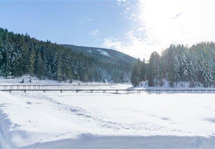
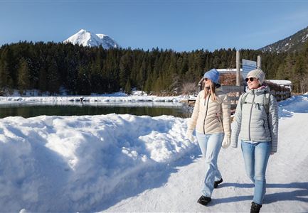
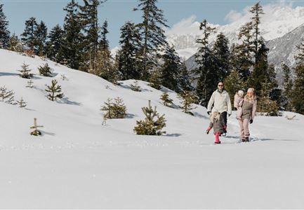
This winter hike starts in the small village of Reith, taking you along the Bee Nature Trail to Seefeld, then through the Reither Auland and around the Wildsee, bringing you back to the starting point.

The route begins directly at Reith Railway Station. From here, follow the snow-covered Reither Waldweg, passing along Römerweg, Kreuzweg, and Lobaweg streets. Shortly after the Bee Nature Trail, the trail crosses the main road and continues along the small lake on Lobaweg to Seefeld. Upon arriving in Seefeld, turn left onto Reitherspitzstraße and head towards the Wildsee. If you like, you can take a small detour through Seefeld's Pedestrian Zone.

The hike continues along the Wildsee promenade, passing by the meadows (Auländer Mähder) at the forest's edge and through the peaceful Reither Auland. A short section of the path goes along the Liftweg before turning left onto Gstoaweg and Möslweg, leading back to the starting point in Reith.

Features & Characteristics

Start Point

Reith Railway Station

End Point

Reith Railway Station

Family-friendly

Yes

Stroller-friendly

Yes
Loop tour

Yes

Similar Tour Suggestions

Funkelnd verschneite Felder vor Scharnitz.jpg

Hiking

W22: Winter Hike from Scharnitz to Gießenbach

Length

6,70 km

Duration

01:50 h

Uphill

40 hm

Downhill

41 hm

Altitude

1009 hm

Difficulty

Easy

Open
Drohnenaufnahme Reith im Winter - Kirche reingezoomt mit Wettersteingebirge im Hintergrund.jpg

Hiking

W34: Winter circular hike "culture path" Reith

Length

4,50 km

Duration

01:30 h

Uphill

116 hm

Downhill

117 hm

Altitude

1128 hm

Difficulty

Easy

Open
Winterwandern in der Region Seefeld_Mann und Frau laufen neben kleiner Holzhütte im Fludertal.jpg

Hiking

W19: Winter hike Wildmoosalm - Fludertal

Length

16,20 km

Duration

05:00 h

Uphill

368 hm

Downhill

361 hm

Altitude

1335 hm

Difficulty

Easy

Open
Winterwandern Paar Oberer Wiesenweg Aufnahme von Paar von Hinten laufen neben Zaun (1).jpg

Hiking

Stage 4: From Wettersteinhütte to Leutasch – Tyrol’s 1. Winter Multi-day Hike

Length

9,50 km

Duration

03:30 h

Uphill

25 hm

Altitude

1717 hm

Difficulty

Medium

Open
Drohnenaufnahme Wettersteinhütte - Nahaufnahme mit Blick ins Wettersteingebirge (1).jpg

Hiking

Stage 3: From Mösern to Wettersteinhütte – Tyrol’s 1. Winter Multi-day Hike

Length

14,00 km

Duration

06:00 h

Uphill

718 hm

Altitude

1719 hm

Difficulty

Medium

Open
Blick auf Scharnitz im Winter

Hiking

W6: Winter Hike from Seefeld to Scharnitz

Length

8,30 km

Duration

05:00 h

Downhill

211 hm

Altitude

1178 hm

Difficulty

Easy

Closed
Winterspatziergang mit Kindern - Katzenkopf Leutasch.jpg

Hiking

W20: Winter hike to the Katzenkopfhütte

Length

5,10 km

Duration

02:15 h

Uphill

231 hm

Altitude

1353 hm

Difficulty

Easy

Open
Wettersteinhütte im Winter - Aufnahme von der Seite mit Sitzbänken.jpg

Hiking

W14: Winter hike to the Wettersteinhütte

Length

8,30 km

Duration

04:00 h

Uphill

504 hm

Altitude

1717 hm

Difficulty

Medium

Open