Start Point

Mösern Information Office

End Point

Mösern Information Office

Difficulty

Easy

Total Distance

4,60 km

Descent Meters

92 m

Ascent Meters

96 m

Highest Point

1292 m

Total Time

01:30 h

Status

Open

Map & Elevation Profile

Start Point

Mösern Information Office

End Point

Mösern Information Office

Difficulty

Easy

Total Distance

4,60 km

Descent Meters

92 m

Ascent Meters

96 m

Highest Point

1292 m

Total Time

01:30 h

Status

Open

Hiking

Best Time

Open

Jan

Feb

Mar

Apr

May

Jun

Jul

Aug

Sep

Oct

Nov

Dec

Winter walking

Hut Winter Hikes

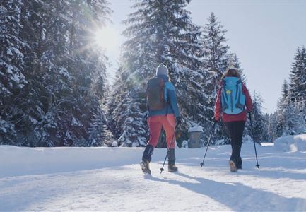
This is a cleared winter hiking trail. However, icy or slippery spots may still occur.

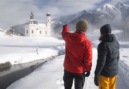
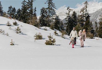
The contemplative peace trail leads from the Mösern Information Office via seven spiritual stations around Lake Möserer See to the Peace Bell. The hike begins at the Mösern information office with the "Aufbrechen" station and leads past a 300-year-old mountain farm with a local history museum to the Gföllkapelle chapel. After crossing the road, the trail continues along the Albrecht Dürer Trail to the "Schauen und Staunen" station. The trail continues along the Möserer Seeweg to the idyllic Möserer See lake and the next way station "Des Menschen Seele gleicht dem Wasser". After circling the Möserer See lake, the trail continues past the "Enge und Ängste" station to the impressive peace bell with the "Ich läute für die gute Nachbarschaft und den Frieden in den Alpenländern" station. High above the Inn Valley, the path continues to the church with the "Werte und Familie" station and the pavilion with the "Weitblick und Verantwortung" station. The peace trail ends again at the Mösern information office, below the pavilion.

Features & Characteristics

Start Point

Mösern Information Office

End Point

Mösern Information Office

Family-friendly

Yes

Loop tour

Yes

Similar Tour Suggestions

Winterwandern im Gaistal_zwei Frauen laufen von der Hämmermoosalm weg.jpg

Hiking

W11: Winter hike to the Hämmermoosalm

Length

4,00 km

Duration

02:00 h

Uphill

173 hm

Downhill

171 hm

Altitude

1410 hm

Difficulty

Easy

Open
Oberer Wiesenweg im Frühwinter_Paar läuft auf Wanderweg_Blick auf Stadl und Hohe Munde.jpg

Hiking

W17: Winter circular hike on the Wiesenweg

Length

6,20 km

Duration

01:45 h

Uphill

61 hm

Altitude

1193 hm

Difficulty

Easy

Open
Zwei Frauen am Winterwandern in Scharnitz.jpg

Hiking

W6: Winter Hike from Seefeld to Scharnitz

Length

8,30 km

Duration

05:00 h

Downhill

211 hm

Altitude

1178 hm

Difficulty

Easy

Open
Weidachsee im Winter

Hiking

W9: Winter circular hike around Weidachsee lake

Length

3,80 km

Duration

01:00 h

Uphill

46 hm

Altitude

1156 hm

Difficulty

Easy

Open
Winterwandern in der Region Seefeld_Mann und Frau laufen neben kleiner Holzhütte im Fludertal.jpg

Hiking

W19: Winter hike Wildmoosalm - Fludertal

Length

11,80 km

Duration

03:30 h

Uphill

250 hm

Altitude

1340 hm

Difficulty

Easy

Open
W18 Schlagweg Rauthgatter Richtung Lottensee und Wildmoos.jpg

Hiking

W16: Winter hike from Leutasch to Seefeld

Length

6,60 km

Duration

02:15 h

Uphill

164 hm

Altitude

1225 hm

Difficulty

Easy

Open
Hofladenrunde im Winter_zwei Frauen bei Thoamlhof laufen zum Hofladen.jpg

Hiking

Winter Circular Hike Leutasch Farm Shop

Length

11,10 km

Duration

03:10 h

Uphill

111 hm

Downhill

108 hm

Altitude

1194 hm

Difficulty

Easy

Open
100000 Lichter-Weg Seefeld_Paar steht auf Pfarrhügel_Reither Spitze in der Distanz.jpg

Hiking

100.000 Lights Path

Length

1,70 km

Duration

00:30 h

Uphill

30 hm

Downhill

39 hm

Altitude

1206 hm

Difficulty

Easy

Closed