Start Point

Parking lot Kirchplatzl (P9)

End Point

Parking lot Kirchplatzl (P9)

Difficulty

Easy

Total Distance

1,80 km

Descent Meters

10 m

Ascent Meters

10 m

Highest Point

1130 m

Total Time

00:30 h

Map & Elevation Profile

Start Point

Parking lot Kirchplatzl (P9)

End Point

Parking lot Kirchplatzl (P9)

Difficulty

Easy

Total Distance

1,80 km

Descent Meters

10 m

Ascent Meters

10 m

Highest Point

1130 m

Total Time

00:30 h

Hiking

Best Time

Jan

Feb

Mar

Apr

May

Jun

Jul

Aug

Sep

Oct

Nov

Dec

Hiking tour

Village walks

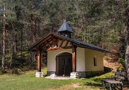
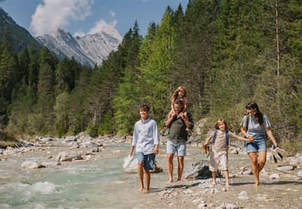
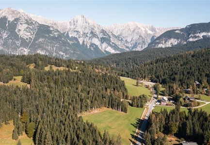
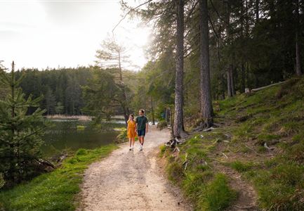
This easy, wheelchair-accessible hiking trail takes you through the Leutasch district of "Kirchplatzl." The trail is flat, wide, and has no particular danger spots. Over the course of 1.8 km, you will walk along the wonderfully calming Leutasch Ache and discover the peaceful, decelerating district.

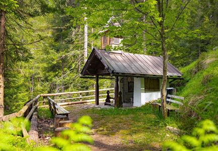
The route starts depending on how you arrive, either at parking lot P9 (by car) or the bus stop Leutasch Kirchplatzl. From the parking lot, cross the street at the zebra crossing, walk briefly to the left along the sidewalk, and then turn right toward the Parish Church St. Magdalena. If you arrive by bus, get off here.Heading north, turn left before the Hotel Xander and follow the road until you reach a junction. At the junction, the road continues either left or right. We take the right side and shortly after, turn left, until we reach the Kühtaierhof. Here you can take a break or turn left just past the opposite playground. Now walk straight ahead for a while, until you come to another junction. Once again, take the middle path and switch from asphalt to gravel.

After a pleasant stretch through the forest, you return to

Features & Characteristics

Start Point

Parking lot Kirchplatzl (P9)

End Point

Parking lot Kirchplatzl (P9)

Loop tour

Yes

Family-friendly

Yes

Stroller-friendly

Yes
Similar Tour Suggestions

Höhenweg Leutasch_Aussichtsplattform Höhenweg_Pfarrkirche St. Magdalena und Ganghofermuseum.jpg

Hiking

Wheelchair Circular Hike Runst-Achweg

Length

6,30 km

Duration

02:00 h

Uphill

40 hm

Altitude

1130 hm

Difficulty

Easy

Partially open
Bodenalm im Sommer (4).jpg

Hiking

Circular hiking traill to the Bodenalm alpine hut

Length

8,40 km

Duration

02:30 h

Uphill

180 hm

Altitude

1198 hm

Difficulty

Easy

Wettersteingebirge und Leutasch im Sommer - Drohnenaufnahme von der Muggenmoosalm.jpg

Hiking

Hike Schlagweg-Rauthgatter-Wildmoos

Length

11,50 km

Duration

03:30 h

Uphill

220 hm

Altitude

1345 hm

Difficulty

Easy

Partially open
kinder_bei_infotafel_in_der_geisterklamm.jpg

Hiking

Short circular trail at the Spirit Gorge

Length

500 m

Duration

00:15 h

Uphill

10 hm

Altitude

1027 hm

Difficulty

Easy

Muggenmoosalm bei Leutasch im Sommer - Drohnenaufnahme.jpg

Hiking

Hike to the Muggenmoosalm alpine hut

Length

3,60 km

Duration

01:15 h

Uphill

80 hm

Altitude

1252 hm

Difficulty

Easy

Partially open
Fischerrei am Weidachsee - Leutasch (1)(1).jpg

Hiking

Circular walk around Weidachsee lake

Length

3,80 km

Duration

01:00 h

Uphill

46 hm

Altitude

1156 hm

Difficulty

Easy

Bienenlehrpfad Reith - Infotafel am Bienenhotel (1).jpg

Hiking

Hike Bee Nature Trail

Length

2,50 km

Duration

01:00 h

Uphill

72 hm

Altitude

1185 hm

Difficulty

Easy

Reith Wiesenweg im Frühling - Drohnenaufnahme strahlend grüne Wiese mit Blick zum Inntal.jpg

Hiking

Circular hiking traill Wiesenweg

Length

4,60 km

Duration

01:30 h

Uphill

109 hm

Altitude

1128 hm

Difficulty

Easy