Start Point

Naturpark Info Center Scharnitz (P2)

End Point

Naturpark Info Center Scharnitz (P2)

Difficulty

Medium

Total Distance

21,20 km

Descent Meters

505 m

Ascent Meters

498 m

Highest Point

1261 m

Total Time

06:30 h

Map & Elevation Profile

Start Point

Naturpark Info Center Scharnitz (P2)

End Point

Naturpark Info Center Scharnitz (P2)

Difficulty

Medium

Total Distance

21,20 km

Descent Meters

505 m

Ascent Meters

498 m

Highest Point

1261 m

Total Time

06:30 h

Hiking

Best Time

Jan

Feb

Mar

Apr

May

Jun

Jul

Aug

Sep

Oct

Nov

Dec

Hiking tour

Circular hike

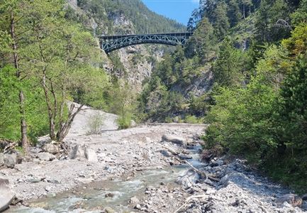
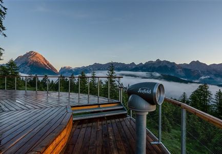
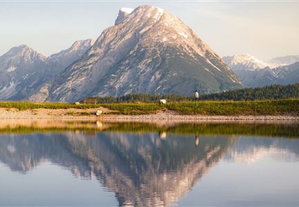
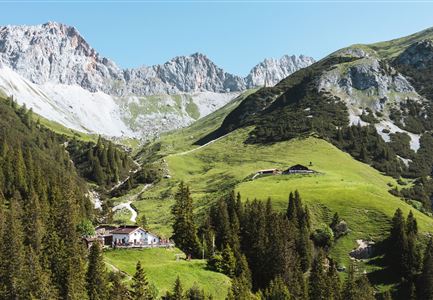
From the Nature Park Information Center in Scharnitz, the route follows the Hinterautalstraße. Turn right to the Isarsteig until it becomes a gently ascending forest path. At the end of the Isarsteig, the path continues onto the Nederweg, past the Scharnitzer Alm, to the entrance of the Gleirschklamm Gorge. A narrow trail leads through the gorge, which is only suitable for experienced and sure-footed hikers. At the end of the trail, the path joins a forest road. Turn left here and continue to the Gleirschtal forest road. From there, head right up the valley towards Möslalm. The return journey can be via the forest road or the same path back through the gorge to the starting point.

Features & Characteristics

Start Point

Naturpark Info Center Scharnitz (P2)

End Point

Naturpark Info Center Scharnitz (P2)

Loop tour

Yes
Videos

Similar Tour Suggestions

Blick vom Predigtstuhl auf das Steinerne Huettl im Gaistal.jpg

Hiking

Bike & Hike to the Steinernes Hüttl alpine hut

Length

19,80 km

Duration

06:00 h

Uphill

980 hm

Altitude

2131 hm

Difficulty

Medium

Wanderung über der Karwendelschlucht - Scharnitz.jpg

Hiking

Circular hiking trail Karwendel Gorge

Length

8,90 km

Duration

03:00 h

Uphill

240 hm

Altitude

1140 hm

Difficulty

Medium

Wanderung zur Eppzirler Alm im Sommer - Mann und Frau von hinten mit Eppzirler Alm.jpg

Hiking

Hike to the Eppzirler Alm alpine hut

Length

12,40 km

Duration

04:00 h

Uphill

475 hm

Altitude

1459 hm

Difficulty

Medium

Spaziergang an der Isar - Scharnitz (2).jpg

Hiking

Circular hiking trail to the Gleirschhöhe

Length

8,60 km

Duration

02:45 h

Uphill

212 hm

Altitude

1074 hm

Difficulty

Medium

Leutascher Geisterklamm mit Blick Richtung Mittenwald.jpg

Hiking

Long Gorge Trail through the Leutasch Spirit Gorge with Themed Trail

Length

3,20 km

Duration

01:30 h

Uphill

129 hm

Downhill

127 hm

Altitude

1060 hm

Difficulty

Medium

Hölzernes Herz am Mühlberg in Scharnitz - Perspektive durch Gebüsch (1).jpg

Hiking

Hike to the Mühlberg Scharnitz

Length

6,50 km

Duration

02:30 h

Uphill

334 hm

Downhill

328 hm

Altitude

1315 hm

Difficulty

Medium

Rauthhütte in Leutasch

Hiking

Circular hiking to Rauthhütte alpine hut & Inntal Valley view

Length

6,20 km

Duration

03:00 h

Uphill

439 hm

Altitude

1599 hm

Difficulty

Medium

Aussichtsplattform Kurblhang - Leutasch.jpg

Hiking

Circular hiking trail viewpoint Kurblhang

Length

3,50 km

Duration

01:30 h

Uphill

181 hm

Altitude

1277 hm

Difficulty

Medium