Start Point

Parking lot P5 'Salzbach' in Gaistal

End Point

Parking lot P5 'Salzbach' in Gaistal

Difficulty

Easy

Total Distance

4,00 km

Descent Meters

175 m

Ascent Meters

175 m

Highest Point

1417 m

Total Time

01:30 h

Map & Elevation Profile

Start Point

Parking lot P5 'Salzbach' in Gaistal

End Point

Parking lot P5 'Salzbach' in Gaistal

Difficulty

Easy

Total Distance

4,00 km

Descent Meters

175 m

Ascent Meters

175 m

Highest Point

1417 m

Total Time

01:30 h

Hiking

Best Time

Jan

Feb

Mar

Apr

May

Jun

Jul

Aug

Sep

Oct

Nov

Dec

Hiking tour

Hut hike

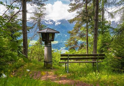
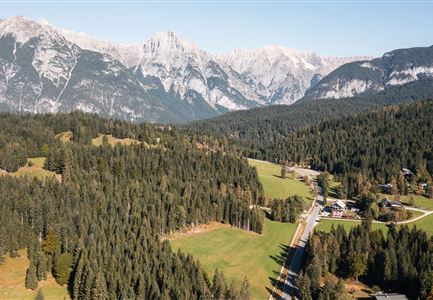
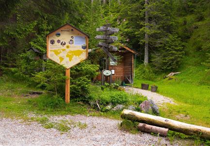
This short and family-friendly hike starts either at the information hut at the entrance to Gaistal, where the path follows the Leutascher Ache and goes upstream until reaching the sign for Hämmermoosalm, or directly from the last (paid) parking lot at Salzbach (P3-5), which provides direct access to the hut's ascent.

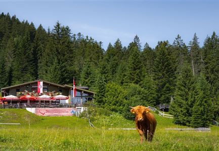
The ascent is easy and follows a wide trail that gradually climbs until reaching the Hämmermoosalm at 1,417 meters. The cozy hut offers a wonderful view and serves delicious local specialties and seasonal dishes.

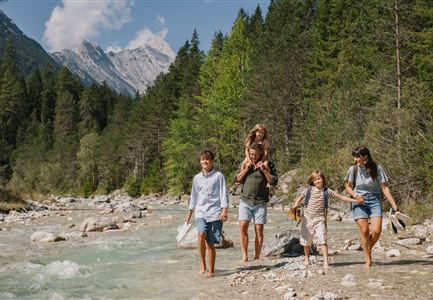
The return follows the same path back to the starting point. Alternatively, the hike can continue to the Gaistalalm (1,366 m) before heading back. A relaxed hike suitable for the whole family, rewarded with a cozy stop at the hut.

Features & Characteristics

Start Point

Parking lot P5 'Salzbach' in Gaistal

End Point

Parking lot P5 'Salzbach' in Gaistal

Family-friendly

Yes
Similar Tour Suggestions

Familien-Weitwanderung im Gaistal - Familie am Zaun vor Gaistalalm.jpg

Hiking

Hike to the Gaistalalm & Tillfussalm alpine hut

Length

9,70 km

Duration

03:00 h

Uphill

229 hm

Altitude

1404 hm

Difficulty

Easy

Familie vor dem Seekirchl im Sommer - 2.jpg

Hiking

Circular walk Seefeld to the Jumping hill

Length

2,00 km

Duration

00:30 h

Uphill

10 hm

Altitude

1195 hm

Difficulty

Easy

Möserer See im Frühling - Paar läuft entlang des Seeweges.jpg

Hiking

Circular walking path from Seefeld to the lake Möserer See

Length

8,80 km

Duration

02:30 h

Uphill

231 hm

Altitude

1297 hm

Difficulty

Easy

Herbstwanderung am Oberen Wiesenweg_Paar läuft entlang von Wiese_Aufnahme gegen die Sonne mit Lärchen im Hintergrund.jpg

Hiking

Circular hiking traill Oberer & Unterer Wiesenweg

Length

6,10 km

Duration

02:00 h

Uphill

64 hm

Altitude

1194 hm

Difficulty

Easy

Reith Wiesenweg im Frühling - Drohnenaufnahme strahlend grüne Wiese mit Blick zum Inntal.jpg

Hiking

Circular hiking traill Wiesenweg

Length

4,60 km

Duration

01:30 h

Uphill

109 hm

Altitude

1128 hm

Difficulty

Easy

Spaziergang mit Hund in Unterleutasch - Mann läuft mit Hund entlang von Bäumen Aufnahme Richtung Sonne.jpg

Hiking

Tour of lawn "toler"

Length

4,20 km

Duration

00:45 h

Uphill

13 hm

Altitude

1072 hm

Difficulty

Easy

Friedensglocke im Herbst - Frau steht am Geländer und blickt ins Inntal beim Sonnenuntergang- Sonnenstern an der Glocke.jpg

Hiking

Peace Bell Hiking Trail

Length

4,60 km

Duration

01:30 h

Uphill

92 hm

Downhill

96 hm

Altitude

1292 hm

Difficulty

Easy

Ropferstubm im Herbst - Moesern-Buchen

Hiking

Hike to the Inn Ropferstub'm

Length

9,20 km

Duration

03:00 h

Uphill

246 hm

Altitude

1316 hm

Difficulty

Easy