Start Point

Information center Mösern

End Point

Information office Mösern
Difficulty

Medium

Total Distance

8,90 km

Descent Meters

281 m

Ascent Meters

281 m

Highest Point

1496 m

Total Time

01:00 h

Map & Elevation Profile

Start Point

Information center Mösern

End Point

Information office Mösern
Difficulty

Medium

Total Distance

8,90 km

Descent Meters

281 m

Ascent Meters

281 m

Highest Point

1496 m

Total Time

01:00 h

Cycling

Best Time

Jan

Feb

Mar

Apr

May

Jun

Jul

Aug

Sep

Oct

Nov

Dec

Mountainbike tour

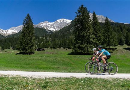
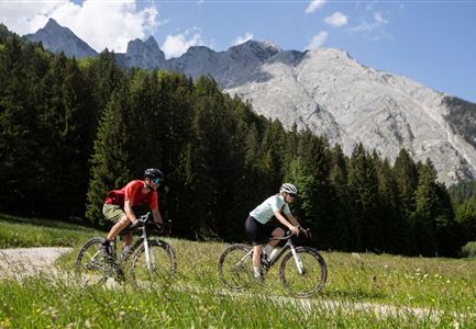
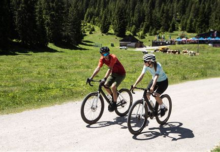
Short but worthwhile bike tour to the Brunschkopf
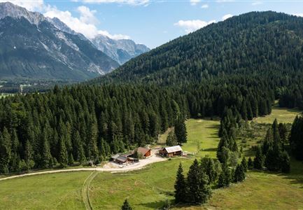
The route offers the only bike connection to the summit of the Brunschkopf and starts directly at the Information center Mösern. From here the route leads well signposted to the Möserer See and further to the junction of the Rundweg Mösern-Wildmoos (circular trail, route 544).

To reach the connecting section onto the Brunschkopf, simply take the gravel road east past the Möserer See, follow it through the Lehenwald (forest) and turn left at the crossroads towards the Lottensee (lake). Follow the moderately difficult ascent for about 500 meters to the top of the hill and then turn right onto Route 5068 towards Brunschkopf. The following 2.6 kilometers and 150 meters in altitude are shared with other hikers, so please drive carefully! To get back to the starting point / parking lot, take the same way back.

Note: This cycle path does not lead directly to the Peace Bell. Nevertheless, it is easily possible to make a small diversions and visit the impressive Peace Bell during your cycle tour. We recommend taking this opportunity to plan a short detour to the Peace Bell!

Features & Characteristics

Start Point

Information center Mösern

End Point

Information office Mösern
Similar Tour Suggestions

535_Triendlweg-Bauernwald_5-(c)-Olympiaregion-Seefeld,-Anna-Rieder-(4).jpg

Cycling

Biketour No. 535 Triendlweg-Bauernwald

Length

8,60 km

Duration

01:10 h

Uphill

217 hm

Altitude

1220 hm

Difficulty

Medium

e-biken_im_gaistal_im_sommer_drohnenaufnahme_zwei_biker_innen_vor_haemmermoosalm.jpg

Cycling

Biketour No. 5047 Gaistal-Hämmermoosalm

Length

3,90 km

Duration

00:30 h

Uphill

171 hm

Altitude

1417 hm

Difficulty

Medium

Seebensee mit Raeder im Vordergrund.jpg

Cycling

Biketour No. 551 Seebensee

Length

27,60 km

Duration

01:40 h

Uphill

561 hm

Downhill

557 hm

Altitude

1581 hm

Difficulty

Medium

Bike Tour durchs Karwendeltal aufs Karwendelhaus - Scharnitz (11).jpg

Cycling

Biketour No. 579 Gleirschtal-Möslalm

Length

22,60 km

Duration

02:30 h

Uphill

392 hm

Altitude

1272 hm

Difficulty

Medium

Gravelbiker auf der Strasse zwischen Seefeld und Leutasch -Abfahrt (1).jpg

Cycling

Bike-connection No. 5052 Seefeld-Leutasch

Length

15,00 km

Duration

00:45 h

Uphill

271 hm

Altitude

1221 hm

Difficulty

Medium

Gravelbike - Anfahrt zur Gaistalalm(1).jpg

Cycling

Bike Trail Tirol Etappe 06: Ehrwald-Scharnitz

Length

40,00 km

Duration

04:00 h

Uphill

990 hm

Downhill

1020 hm

Altitude

1590 hm

Difficulty

Medium

551_Gaistal-Seebensee---Blick-Zugpsitze-und-Seebenalm--(c)-Olympiaregion-Seefeld,-Anna-Rieder-(5).jpg

Cycling

Biketour Zugspitz-8

Length

104,00 km

Duration

10:00 h

Uphill

1687 hm

Altitude

1596 hm

Difficulty

Medium

Partially open
Leutascher Ache im Sommer mit Blick auf die Hohe Munde - Weidach - 1350x1080.jpg

Cycling

Biketour Arnspitzrunde

Length

33,00 km

Duration

03:30 h

Uphill

380 hm

Altitude

1220 hm

Difficulty

Medium