Start Point

Seefeld Triendlsäge

End Point

Seefeld Triendlsäge

Difficulty

Medium

Total Distance

8,60 km

Descent Meters

217 m

Ascent Meters

217 m

Highest Point

1220 m

Total Time

01:10 h

Map & Elevation Profile

Start Point

Seefeld Triendlsäge

End Point

Seefeld Triendlsäge

Difficulty

Medium

Total Distance

8,60 km

Descent Meters

217 m

Ascent Meters

217 m

Highest Point

1220 m

Total Time

01:10 h

Cycling

Best Time

Jan

Feb

Mar

Apr

May

Jun

Jul

Aug

Sep

Oct

Nov

Dec

Mountainbike tour

Loop tour

Route: Waldgasthof Triendlsäge – Triendlweg - Bauernwald – Unterkelle/Neuleutasch - Waldgasthof Triendlsäge

Route description:

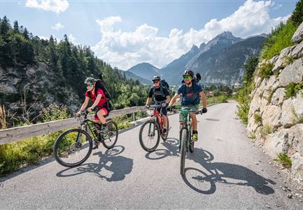
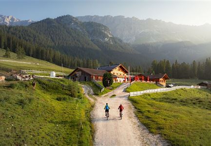
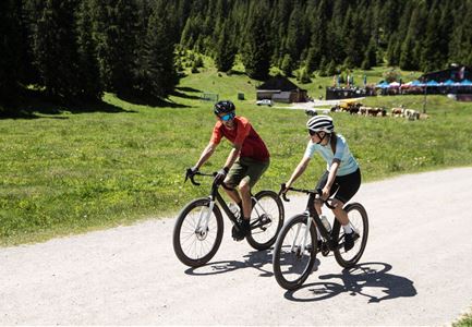
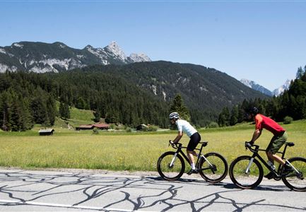
This beautiful and easy biking loop (route no. 535) crosses picturesque forest areas and rewards with a rustic stop full of delicious temptations at Gasthof Triedlsäge.


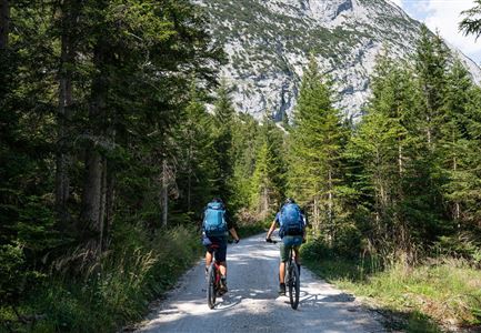
The starting point at the Triendlsäge can be reached directly and comfortably from Seefeld, but you can also easily drive there in your own car (parking lot only for restaurant guests). At the old sawmill get yourself in the saddle and calmly cycle along the asphalted Triendlweg downhill towards Scharnitz. At the Lehenwald junction, turn left onto the forest road and continue to the next hairpin bend. There, take a sharp left turn and cycle above the outward trail through the Bauernwald (trail no. 19) to the Unterkelle bus stop in Neuleutasch (keep right).


From there, follow the main road on the left for a short distance until the gravel path to the Triendlsäge branches off to the left. Back at the idyllic forest inn, the tempting smell of fresh Kaiserschmarrn is already wafting towards you. If you like it hearty, you should not miss the freshly caught trout from the own pond!

Alpine emergency call:

Call: 140

Features & Characteristics

Start Point

Seefeld Triendlsäge

End Point

Seefeld Triendlsäge

Loop tour

Yes
Similar Tour Suggestions

Möserer See im Frühling - Paar auf Liege vor Möserer Seestube von aus der Entfernung.jpg

Cycling

Biketour Seefeld - Mösern - Wildmoos - Katzenkopf - Fludertal - Seefeld

Length

27,20 km

Duration

04:00 h

Uphill

657 hm

Downhill

651 hm

Altitude

1368 hm

Difficulty

Medium

Gravelbike - Anfahrt zur Gaistalalm

Cycling

Bike Trail Tirol Etappe 06: Ehrwald-Scharnitz

Length

40,00 km

Duration

04:00 h

Uphill

990 hm

Downhill

1020 hm

Altitude

1590 hm

Difficulty

Medium

Wildmoos (c) Anna Rieder

Cycling

Biketour No. 5069 Seefeld-Wildmoos

Length

6,30 km

Duration

00:30 h

Uphill

122 hm

Downhill

120 hm

Altitude

1308 hm

Difficulty

Medium

Radfahrerin beim Sonnenaufgang im Gaistal - 02.jpg

Cycling

Gravelbiketour Gaistal

Length

18,10 km

Duration

01:45 h

Uphill

353 hm

Downhill

194 hm

Altitude

1363 hm

Difficulty

Medium

Partially open
Gravelbiker auf der Strasse zwischen Seefeld und Leutasch -Abfahrt

Cycling

Bike-connection No. 5052 Seefeld-Leutasch

Length

15,00 km

Duration

00:45 h

Uphill

271 hm

Altitude

1221 hm

Difficulty

Medium

Gravelbiker auf dem Radweg zum Brunschkopf im Sommer (2).jpg

Cycling

Biketour No. 544 Mösern-Wildmoos around the Brunschkopf

Length

11,50 km

Duration

01:30 h

Uphill

300 hm

Altitude

1387 hm

Difficulty

Medium

Gravelbiker bei der Wildmoosalm im Sommer

Cycling

Biketour No. 547 Wildmoos-Buchen

Length

8,80 km

Duration

00:25 h

Uphill

184 hm

Downhill

183 hm

Altitude

1346 hm

Difficulty

Medium

Partially open
Wildmoosalm im Sommer - Hütte mit Kuh.jpg

Cycling

Gravelbiketour Wildmoos

Length

20,00 km

Duration

03:15 h

Uphill

450 hm

Altitude

1510 hm

Difficulty

Medium