Start Point
Information office Scharnitz (P2)
End Point
Information office Scharnitz (P2)
Difficulty
Medium
Total Distance
25,00 km
Descent Meters
420 m
Ascent Meters
420 m
Highest Point
1249 m
Total Time
04:00 h
Hiking
Best Time
Jan
Feb
Mar
Apr
May
Jun
Jul
Aug
Sep
Oct
Nov
Dec
Bike & Hike
Hiking tour
To save time, it is recommended to take the bike up to crossing Kristenalm/Möslalm and then continue on foot to the Kristenalm.
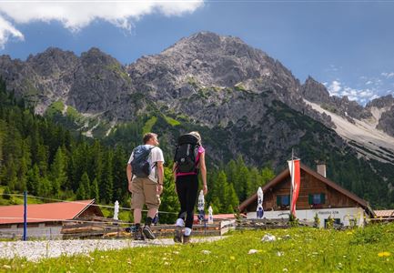
From the Scharnitz Nature Park Info Center follow the forest road into the Gleirschtal and after a few kilometers leave your bike at the junction into the Kristental. From here, continue on to the Kristenalm on foot (bikes are not allowed). Return to the starting point along the same path.
Details for one direction:
- Bike route nr. 579: approx. 10 km, 260 hm uphill, 01:15 h, difficulty: medium
- Hike route: approx. 2,5 km, 160 hm uphill, 01:00 h, difficulty: easy
Hint:
If you want to enjoy the landscape even more, you can hike along a narrow path to the Solsteinhaus (another 3.5 km, 620 hm uphill, 02:00 h, difficulty: medium). Once there, you can climb the Großer Solstein (2,541m) in another 2-3 hrs. An overnight stay at the Solsteinhaus is recommended for the extension. Once at the summit, you can enjoy a panoramic view from the Zugspitze in the west, the Karwendel mountains in the north to the Stubai and Zillertal mountains in the
Features & Characteristics
Start Point
Information office Scharnitz (P2)
End Point
Information office Scharnitz (P2)
