We use cookies for your personalized browsing experience, to personalize content and ads, to provide social media features, and to analyze traffic to our website. We also share information about your use of our website with our social media, advertising and analytics partners. Our partners may combine this information with other data that you have provided to them or that they have collected as part of your use of the Services. (incl. US providers)

Start Point

Parkplatz Länd (P2)

End Point

Parkplatz Länd (P2)

Difficulty

Medium

Total Distance

15,20 km

Descent Meters

794 m

Ascent Meters

789 m

Highest Point

1743 m

Total Time

06:00 h

Map & Elevation Profile

Start Point

Parkplatz Länd (P2)

End Point

Parkplatz Länd (P2)

Difficulty

Medium

Total Distance

15,20 km

Descent Meters

794 m

Ascent Meters

789 m

Highest Point

1743 m

Total Time

06:00 h

Hiking

Best Time

Jan

Feb

Mar

Apr

May

Jun

Jul

Aug

Sep

Oct

Nov

Dec

Hiking tour

Hut hikes

+2

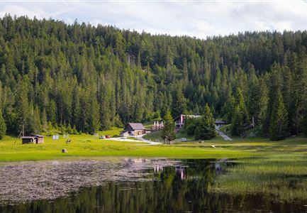
Route: Scharnitz Nature Park Information Center - Café Länd - Bärenklamm - Mühlberg Forstweg - Mühlberg Lift Mountain Station - Mittagskopf - Zäunlkopf - Oberbrunnalm - Giessenbach - Scharnitz

Parking and public transport:

P2 "Karwendelparkplatz Länd".

By train to Scharnitz train station (10 minutes walk to the starting point).

You can find all connections in real time with the Mobility-App "wegfinder".

Directions:

From the Scharnitz Nature Park Info Center, turn right to Café Länd, directly opposite a small

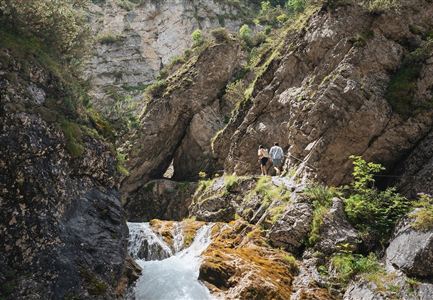
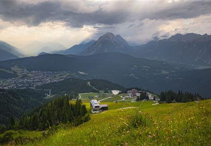
Directly opposite, climb a small hill and turn right into the dirt road, continue left towards the Mühlberg parking lot. After the last house on the left, the ascent begins in serpentines on a narrow, partly steep path through the Bärenklamm (signpost). This path (surefootedness required) leads through shady high forest to the Mühlberg forest road. Continue on the ascending path to the former mountain station Mühlberglift. From there further ascent on a narrow path to the left to the Mittagskopf and Zäunlkopf. The detour to the beautiful view (approx. 10 min) rewards with a magnificent view of the Karwendel valleys. From the Zäunlkopf begins the descent, continuing to follow the signs to the Oberbrunnalm. Return via the Gießenbach

Read More...

Recommended Equipment

Trittsicherheit und gutes Schuhwerk.

Features & Characteristics

Start Point

Parkplatz Länd (P2)

End Point

Parkplatz Länd (P2)

Loop tour

Yes

Similar Tour Suggestions

Brunschkopf Panorama

Hiking

Brunschkopf viewing platform via Geiernest from Seefeld, return via Wildmoosalm

Length

9,20 km

Duration

03:00 h

Uphill

325 hm

Altitude

1493 hm

Difficulty

Medium

Rosenkranzweg in Reith

Hiking

On the rosary walking trail to the Frau Häusl chapel

Length

1,20 km

Duration

01:15 h

Uphill

100 hm

Altitude

1220 hm

Difficulty

Easy

Pfarrkirche im Sommer - Moesern

Hiking

Hike to the Inn Ropferstub'm

Length

9,20 km

Duration

03:00 h

Uphill

246 hm

Altitude

1316 hm

Difficulty

Easy

Schlossbachklamm.jpg

Hiking

Hike through the Schlossbachklamm

Length

6,10 km

Duration

02:00 h

Uphill

107 hm

Downhill

299 hm

Altitude

1065 hm

Difficulty

Easy

Bike Tour durchs Karwendeltal aufs Karwendelhaus - Scharnitz

Hiking

Karwendel March 35 km

Length

35,00 km

Duration

12:30 h

Uphill

1664 hm

Downhill

1358 hm

Altitude

1843 hm

Difficulty

Hard

Porta Claudia Ruine - Scharnitz

Hiking

Circular hiking trail Porta Claudia

Length

2,50 km

Duration

01:00 h

Uphill

125 hm

Downhill

120 hm

Altitude

1085 hm

Difficulty

Easy

Kinder bei Infotafel in der Geisterklamm.jpg

Hiking

Short Gorge Trail (with theme path)

Length

500 m

Uphill

10 hm

Difficulty

Easy

Closed
Pfarrhuegel in Seefeld.jpg

Hiking

Village tour lake Wildsee via Pfarrhügel

Length

3,20 km

Duration

01:00 h

Uphill

23 hm

Altitude

1203 hm

Difficulty

Easy