We use cookies for your personalized browsing experience, to personalize content and ads, to provide social media features, and to analyze traffic to our website. We also share information about your use of our website with our social media, advertising and analytics partners. Our partners may combine this information with other data that you have provided to them or that they have collected as part of your use of the Services. (incl. US providers)

Start Point

Parking Katzenkopflift (P14)

End Point

Parking Katzenkopflift (P14)

Difficulty

Easy

Total Distance

5,10 km

Descent Meters

231 m

Highest Point

1353 m

Total Time

02:15 h

Status

Open

Map & Elevation Profile

Start Point

Parking Katzenkopflift (P14)

End Point

Parking Katzenkopflift (P14)

Difficulty

Easy

Total Distance

5,10 km

Descent Meters

231 m

Highest Point

1353 m

Total Time

02:15 h

Status

Open

Hiking

Best Time

Open

Jan

Feb

Mar

Apr

May

Jun

Jul

Aug

Sep

Oct

Nov

Dec

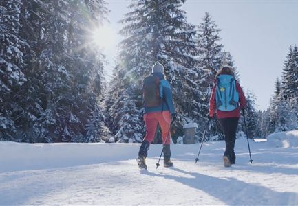
Winter walking

Route: Leutasch Katzenkopf valley station - Katzenkopf hut - Leutasch Katzenkopf valley station

Parking and public transport:

P14 "Katzenkopf".

The fastest public connection to the starting point can be found directly in our route planner.

By train to Seefeld train station and continue with the Regio-/Skibus to the stop "Leutasch Kreithkapelle".

You can find all connections in real time with the Mobility-App "wegfinder".

Directions:

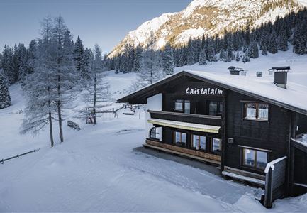
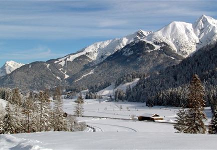
Directly from the valley station of the versatile Leutascher Katzenkopf, a wonderful hiking route leads up the mountain.

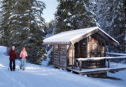
As you can also toboggan on the same route in winter and the ascent crosses the ski slope twice on the way, it is essential to watch out for oncoming traffic on the way! If necessary, you can also get a rental toboggan at the valley station for a small fee; alternatively, hiking trails lead from the cosy Katzenkopfhütte (1,360m) at the summit on to Wildmoos, Seefeld and Mösern.

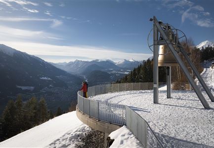
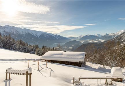
From the sun terrace of the traditional wooden hut, an impressive mountain panorama stretches over the extensive Leutasch valley, which you can simply take in here while enjoying homemade delicacies, freshly tapped refreshments and steaming hot drinks. Those who prefer to warm up indoors will find a cosy

Read More...

Features & Characteristics

Start Point

Parking Katzenkopflift (P14)

End Point

Parking Katzenkopflift (P14)

Similar Tour Suggestions

Ropferstubm in Buchen bei Mösern - Ausblick

Hiking

W26: Winter hike Mösern - Ropferstub'm

Length

12,10 km

Duration

04:15 h

Uphill

335 hm

Downhill

330 hm

Altitude

1316 hm

Difficulty

Easy

Open
Hohe Munde

Hiking

Long distance hiking in snow section 4

Length

9,50 km

Duration

03:30 h

Uphill

25 hm

Altitude

1717 hm

Difficulty

Medium

Open
Winterweitwandern Fludertal

Hiking

W19: Winter hike Wildmoosalm - Fludertal

Length

16,20 km

Duration

05:30 h

Uphill

377 hm

Altitude

1342 hm

Difficulty

Easy

Open
Winterwanderweg - Neuleutasch

Hiking

W16: Winter hike from Leutasch to Seefeld

Length

6,60 km

Duration

02:15 h

Uphill

164 hm

Altitude

1225 hm

Difficulty

Easy

Open
Wildmoosalm im Winter

Hiking

W1: Winter circular hike Mösern - Wildmoos

Length

13,00 km

Duration

04:00 h

Uphill

247 hm

Altitude

1333 hm

Difficulty

Medium

Open
Winterwanderweg nach Seefeld - Auland

Hiking

W7: Winter circular hike Reith - Seefeld - Reith

Length

8,90 km

Duration

02:30 h

Uphill

122 hm

Altitude

1199 hm

Difficulty

Easy

Open
W6 Ahrnspitzen am Winterwanderweg nach Scharnitz - Seefeld

Hiking

W6: Winter hike from Seefeld to Scharnitz

Length

8,30 km

Duration

02:30 h

Downhill

211 hm

Altitude

1183 hm

Difficulty

Easy

Open
KlammPlaik_im Winter

Hiking

W10: Winter hike through the Leutasch Valley

Length

13,20 km

Duration

03:45 h

Uphill

13 hm

Altitude

1174 hm

Difficulty

Easy

Open