Start Point

Information office Scharnitz (P2)

End Point

Information office Scharnitz (P2)

Difficulty

Medium

Total Distance

37,00 km

Descent Meters

850 m

Ascent Meters

850 m

Highest Point

1771 m

Total Time

04:00 h

Map & Elevation Profile

Start Point

Information office Scharnitz (P2)

End Point

Information office Scharnitz (P2)

Difficulty

Medium

Total Distance

37,00 km

Descent Meters

850 m

Ascent Meters

850 m

Highest Point

1771 m

Total Time

04:00 h

Cycling

Best Time

Jan

Feb

Mar

Apr

May

Jun

Jul

Aug

Sep

Oct

Nov

Dec

Mountainbike tour

The classic among the tours

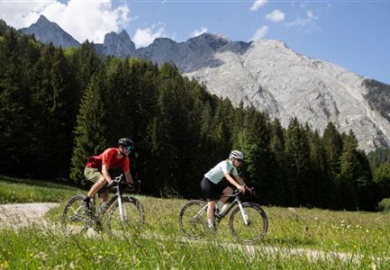
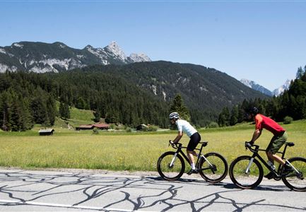
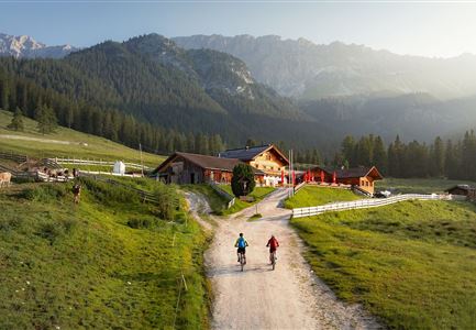
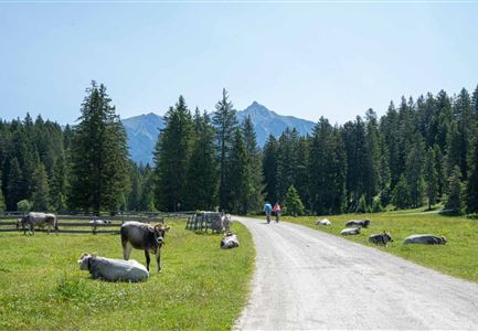
At the information centre Scharnitz / parking Länd (P2) pass the Museum Holzerhütte. After approx. 1 km after the Isar bridge, turn left towards Karwendeltal/Karwendelhaus. A short, steep ascent follows to Brandlegg with a view of the neighbouring valleys. Here you cycle further along the stream Karwendelbach to the Angeralm (not managed). After a few serpentines a steep ascent follows to the Hochalm (not managed) and after a few hairpin bends you reach the turnoff to the nearby Hochalmsattel, the view into the Karwendel (1803 m). The magnificent panoramic view will certainly remain in your memory for a long time. Then continue to the Karwendelhaus (1771 m), a contemporary yet traditional mountain hut. The more than 100 year old restaurant or the sunny terrace with a fantastic view of the Karwendel valley and the western Karwendel peak, as well as traditional dishes invite you to take a well-deserved break. To get back to the starting point / parking lot, take the same way back.

Alternative (see also description Bike Trail Tirol Etappe 07: Scharnitz-Achensee): For experienced bikers with good physical condition this tour can be extended to the

Features & Characteristics

Stamina

Technique

Start Point

Information office Scharnitz (P2)

End Point

Information office Scharnitz (P2)
Similar Tour Suggestions

Wildmoos (c) Anna Rieder

Cycling

Biketour No. 5069 Seefeld-Wildmoos

Length

6,30 km

Duration

00:30 h

Uphill

122 hm

Downhill

120 hm

Altitude

1308 hm

Difficulty

Medium

Reith-Wiesenwegrunde (c) Anna Rieder

Cycling

Biketour No. 5031 Reith-Wiesenweg

Length

4,60 km

Duration

00:35 h

Uphill

109 hm

Downhill

110 hm

Altitude

1129 hm

Difficulty

Medium

Pfarrkirche im Sommer - Moesern (2).jpg

Cycling

Biketour No. 5068 Mösern-Brunschkopf

Length

8,90 km

Duration

01:00 h

Uphill

281 hm

Altitude

1496 hm

Difficulty

Medium

Gaistal-Seebensee-Blick-Zugpsitze-und-Seebenalm (c) Anna Rieder

Cycling

Biketour Zugspitz-8

Length

104,00 km

Duration

10:00 h

Uphill

1687 hm

Altitude

1596 hm

Difficulty

Medium

Partially open
X-547_Wildmoos-Buchen---Ropferstubm-(c)-Olympiaregion-Seefeld,-Anna-Rieder-(13).jpg

Cycling

Biketour No. 5067 Salzbach-Ropferstub'm

Length

16,40 km

Duration

02:00 h

Uphill

472 hm

Altitude

1312 hm

Difficulty

Medium

Muggenmoosalm bei Leutasch im Sommer - Drohnenaufnahme.jpg

Cycling

Biketour No. 5048 Muggenmoosalm

Length

14,80 km

Duration

01:45 h

Uphill

326 hm

Downhill

323 hm

Altitude

1370 hm

Difficulty

Medium

Seebensee mit Raeder im Vordergrund

Cycling

Biketour No. 551 Seebensee

Length

27,60 km

Duration

01:40 h

Uphill

561 hm

Downhill

557 hm

Altitude

1581 hm

Difficulty

Medium

Wildmoosalm im Sommer - Hütte mit Kuh.jpg

Cycling

Gravelbiketour Wildmoos

Length

20,00 km

Duration

03:15 h

Uphill

450 hm

Altitude

1510 hm

Difficulty

Medium