Start Point

Information office Reith

End Point

Information office Reith
Difficulty

Medium

Total Distance

12,60 km

Descent Meters

370 m

Ascent Meters

370 m

Highest Point

1500 m

Total Time

02:00 h

Map & Elevation Profile

Start Point

Information office Reith

End Point

Information office Reith
Difficulty

Medium

Total Distance

12,60 km

Descent Meters

370 m

Ascent Meters

370 m

Highest Point

1500 m

Total Time

02:00 h

Cycling

Best Time

Jan

Feb

Mar

Apr

May

Jun

Jul

Aug

Sep

Oct

Nov

Dec

Mountainbike tour

Bike tour to Reitherjoch Alm with tour highlight "bee trail"

Turn left in front of the information office Reith and follow the main road until you reach the underpass. Shortly before the underpass, turn right into the Bee Trail, which leads parallel to the railway tracks into the forest. Follow the approx. 3 km long path in the direction of Seefeld.

Highlight along the route: The Reither Bee Trail: 10 information boards give an insight into the mysterious life of the honey bee and its relatives, the solitary bee and the bumblebee. In the bee hotel the colourful hustle and bustle in the beehive can be safely observed through a glass window.

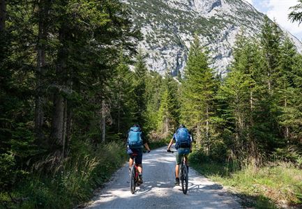
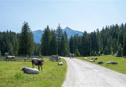
At the end of the gravel road you reach an asphalted road, which leads right up to the Ichtyolwerk. Cross this road and then turn right into Reither Jochweg. Follow the gravel road uphill until you reach the Reitherjochalm after about an hour. On the hut you will be spoiled by the Hüttenwirts family with Tyrolean specialities and homemade cakes.To get back to the starting point / parking lot, take the same way back.

Attention pasture cattle, please keep distance and cross the pasture area calmly and quickly.

Features & Characteristics

Start Point

Information office Reith

End Point

Information office Reith
Similar Tour Suggestions

Seebensee mit Raeder im Vordergrund

Cycling

Biketour No. 551 Seebensee

Length

27,60 km

Duration

01:40 h

Uphill

561 hm

Downhill

557 hm

Altitude

1581 hm

Difficulty

Medium

Wildmoosalm im Sommer - Hütte mit Kuh.jpg

Cycling

Gravelbiketour Wildmoos

Length

20,00 km

Duration

03:15 h

Uphill

450 hm

Altitude

1510 hm

Difficulty

Medium

Gravelbike - Anfahrt zur Gaistalalm

Cycling

Bike Trail Tirol Etappe 06: Ehrwald-Scharnitz

Length

40,00 km

Duration

04:00 h

Uphill

990 hm

Downhill

1020 hm

Altitude

1590 hm

Difficulty

Medium

Partially open
Leutascher Ache im Sommer mit Blick auf die Hohe Munde - Weidach - 1350x1080.jpg

Cycling

Biketour Arnspitzrunde

Length

33,00 km

Duration

03:30 h

Uphill

380 hm

Altitude

1220 hm

Difficulty

Medium

Reith-Wiesenwegrunde (c) Anna Rieder

Cycling

Biketour No. 5031 Reith-Wiesenweg

Length

4,60 km

Duration

00:35 h

Uphill

109 hm

Downhill

110 hm

Altitude

1129 hm

Difficulty

Medium

Bike Tour durchs Karwendeltal aufs Karwendelhaus - Scharnitz (11).jpg

Cycling

Biketour No. 579 Gleirschtal-Möslalm

Length

22,60 km

Duration

02:30 h

Uphill

392 hm

Altitude

1272 hm

Difficulty

Medium

Gravelbiker in Scharnitz im Sommer

Cycling

Bike-connection No. 5051 Seefeld-Scharnitz

Length

25,30 km

Duration

01:45 h

Uphill

256 hm

Downhill

250 hm

Altitude

1195 hm

Difficulty

Medium

Gravelbiker auf dem Radweg zum Brunschkopf im Sommer (2).jpg

Cycling

Biketour No. 544 Mösern-Wildmoos around the Brunschkopf

Length

11,50 km

Duration

01:30 h

Uphill

300 hm

Altitude

1387 hm

Difficulty

Medium