Start Point

Parking Salzbach (P3-5)

End Point

Parking Salzbach (P3-5)

Difficulty

Medium

Total Distance

27,60 km

Descent Meters

561 m

Ascent Meters

557 m

Highest Point

1581 m

Total Time

01:40 h

Map & Elevation Profile

Start Point

Parking Salzbach (P3-5)

End Point

Parking Salzbach (P3-5)

Difficulty

Medium

Total Distance

27,60 km

Descent Meters

561 m

Ascent Meters

557 m

Highest Point

1581 m

Total Time

01:40 h

Cycling

Best Time

Jan

Feb

Mar

Apr

May

Jun

Jul

Aug

Sep

Oct

Nov

Dec

Mountainbike tour

Nature jewel: The Gaistal valley and the lake Seebensee

In 2017 this little paradise was voted the most beautiful place in Tyrol in the austrian TV show "9 places, 9 treasures".

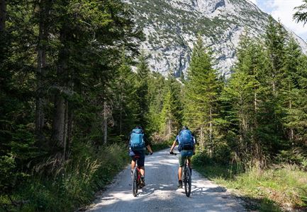
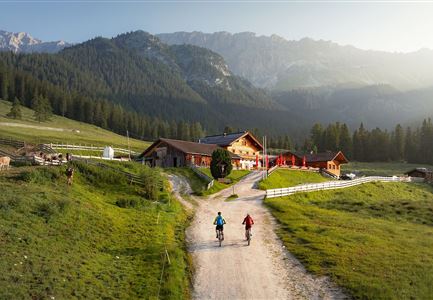
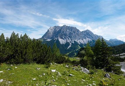
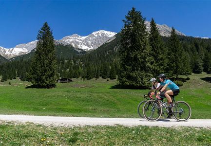
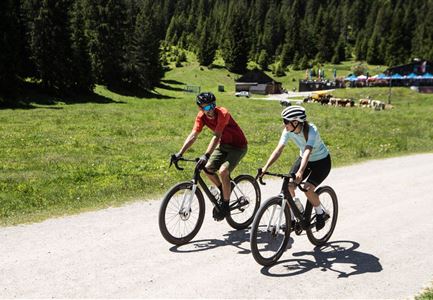
This route is one of the most popular cycling routes in the region and leads through the wildly romantic Gaistal. The panoramic and only slightly ascending forest path starts at theSalzbach car park and runs along the river Leutascher Ache, passing the huts Gaistal- & Tillfussalm to the lake Seebensee (the last kilometre is steep and partly on coarse gravel). Route 551 ends at the confluence with Route 813, which you follow until you reach the Seebensee. Refreshments are available at the Seebenalm or after a short (approx. 50 min) but steep walk to the Coburger Hütte. There, not only regional delicacies await the visitors, but also a stunning view of the previously hidden Drachensee, the crystal-clear Seebensee and the Zugspitze. To get back to the starting point / parking lot, take the same way back.

Attention pasture cattle, please keep distance and cross the pasture area calmly and quickly.

Features & Characteristics

Start Point

Parking Salzbach (P3-5)

End Point

Parking Salzbach (P3-5)

Similar Tour Suggestions

Wildmoosalm im Sommer - Hütte mit Kuh.jpg

Cycling

Gravelbiketour Wildmoos

Length

20,00 km

Duration

03:15 h

Uphill

450 hm

Altitude

1510 hm

Difficulty

Medium

Leutascher Ache im Sommer mit Blick auf die Hohe Munde - Weidach - 1350x1080.jpg

Cycling

Biketour Arnspitzrunde

Length

33,10 km

Duration

03:30 h

Uphill

377 hm

Altitude

1220 hm

Difficulty

Medium

535_Triendlweg-Bauernwald_5-(c)-Olympiaregion-Seefeld,-Anna-Rieder-(4).jpg

Cycling

Biketour No. 535 Triendlweg-Bauernwald

Length

8,60 km

Duration

01:10 h

Uphill

217 hm

Altitude

1220 hm

Difficulty

Medium

Leutascher Ache im Sommer - Drohnenaufnahme Kurve im Fluss (1).jpg

Cycling

Biketour - Adventure Ride

Length

48,50 km

Duration

05:00 h

Uphill

1071 hm

Altitude

1510 hm

Difficulty

Medium

Bike-Tour-durchs-Karwendeltal-aufs-Karwendelhaus

Cycling

Biketour No. 595 Karwendeltal-Karwendelhaus

Length

37,00 km

Duration

04:00 h

Uphill

850 hm

Altitude

1771 hm

Difficulty

Medium

Muggenmoosalm bei Leutasch im Sommer - Drohnenaufnahme.jpg

Cycling

Biketour No. 5048 Muggenmoosalm

Length

14,80 km

Duration

01:45 h

Uphill

326 hm

Downhill

323 hm

Altitude

1370 hm

Difficulty

Medium

Pfarrkirche im Sommer - Moesern

Cycling

Biketour No. 5068 Mösern-Brunschkopf

Length

8,90 km

Duration

01:00 h

Uphill

281 hm

Altitude

1496 hm

Difficulty

Medium

Gravelbike - Anfahrt zur Gaistalalm

Cycling

Bike Trail Tirol Etappe 06: Ehrwald-Scharnitz

Length

40,00 km

Duration

04:00 h

Uphill

990 hm

Downhill

1020 hm

Altitude

1590 hm

Difficulty

Medium