A True Nature Experience
Biking in the Karwendel Nature Park
Covering 739 km², the Karwendel Nature Park is Tyrol’s largest protected area and the biggest nature park in Austria. Located on Tyrol’s high plateau, the park offers a vast network of trails through peaceful valleys, alpine meadows and pristine forests – perfect for diverse biking adventures. Whether you prefer relaxed rides along wild rivers, scenic routes to rustic alpine huts, or sporty climbs on challenging alpine terrain – biking in the Karwendel offers the right route for every fitness level and ambition.
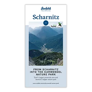
Scharnitz, known as the “Gateway to the Karwendel”, is the ideal starting point for bikers and nature lovers. The main hub is the Nature Park Information Centre, located right next to the P2 “Karwendelparkplatz Länd” car park. From May to October, visitors can find tour suggestions, brochures, and maps here. Attached to the centre is the Holzerhütte Museum, which provides fascinating insights into traditional alpine forestry in the Karwendel. Four impressive valleys – Karwendel Valley, Hinterautal, Gleirschtal, and Gießenbachtal – offer unforgettable biking routes.
Leutasch, on the northwestern edge of the Karwendel, provides access to a scenic biking route around the Große Arnspitze. The trail runs beneath towering peaks and combines natural beauty with athletic challenge – ideal for those who enjoy biking off the beaten path. Seefeld and Reith also offer routes into the southwestern corner of the Karwendel – the Erlspitz Group, also known as the “Seefeld Range.”
Hinterautal Valley & the Source of the River Isar
The peaceful Hinterautal Valley stretches gently along the crystal-clear waters of the river Isar all the way to its source, known as “Bei den Flüssen” (At the Rivers). In this idyllic valley, rustic alpine huts invite you to pause and enjoy the surroundings.


Karwendeltal Valley
A pristine valley featuring challenging ascents for hikers and bikers. The Karwendelhaus, perched at 1,765 metres at the end of the valley, offers visitors sweeping panoramic views. It serves as the starting point for many alpine tours and marks the first stage of the legendary Karwendel March.


Gleirschtal Valley
A quiet valley for explorers and nature lovers. Scenic bike and forest trails lead deep into the heart of the Karwendel – past rustic alpine huts and through unspoiled nature.


Gießenbachtal Valley
From Gießenbach, another wild and romantic valley opens up – ideal for anyone seeking peace and quiet in nature.

Arnspitz Group
With the addition of the Arnspitze nature reserve, the Karwendel Nature Park expanded to 739 km². In the municipality of Leutasch, bikers can enjoy a scenic route around the Große Arnspitze.

Erlspitz Group
The Erlspitz Group, also known as the Seefeld Range, forms the southwestern corner of the Karwendel Mountains. From Seefeld, a varied Bike & Hike tour leads to the Seefelder Spitze (2,220 m) – a combination of a sporty bike ride and a scenic summit ascent with impressive views over Tyrol’s high plateau and the Karwendel valleys.

Taxi Rides into the Valleys and Boat Transport into Hinterautal
From 1ˢᵗ June to 15ᵗʰ October every year
• Taxi and Minibus Mair – Scharnitz T. +43 5213 5363
• Taxi Ramona – Giessenbach T. +43 5213 5541
Please contact the companies directly for information about rates and availability.
Note for Karwendel Valley and Eppzirl: Transfers are only allowed on weekdays and are limited to a maximum of 4 trips per day. No transfers are permitted on weekends and public holidays.

Code of Conduct
Your safety and the protection of our unique nature are very important to us. Please enjoy this beautiful landscape with respect. By following these ten simple rules, you actively contribute to preserving this natural paradise.
Commercial filming and photography in the Karwendel Nature Park are becoming increasingly popular. However, due to the area's special protected status, official permission and compliance with specific rules are required. Detailed information on how to apply for a filming or photography permit can be found on this page.
Please also follow the general rules of conduct for the Karwendel Nature Park.
Important information for mountain bikers can be found here.