



von Zeit.los Magazin
01 August 2019
SUMMER
Karwendel High Trail: Long-distance hiking amidst giants
Since this summer, the Karwendel mountain range has gained a very special hiking attraction: the Karwendel High Trail. Over 6 days, you can hike from hut to hut in the Karwendel mountains and enjoy the unique views of the imposing mountain world, the cozy hut atmosphere, and the best Tyrolean delicacies. In the report from the zeit.los magazine, you will learn what makes the new long-distance hiking trail so "wonderfully hikeable":
The Karwendel is not a mountain range like any other. Along the Nordkette, which borders the Karwendel to the south, one catches a glimpse into two worlds that could not be more contrasting...

Mrs. Hitt - Karwendel High Trail Stage
On one hand, the densely populated Inn Valley lies at your feet, where lively activity prevails, while on the other hand, one experiences the idyllic mountain solitude of the Karwendel Nature Park, which in many places hardly suggests human influence. And in fact, large parts of the Karwendel are almost devoid of people. That is why the mountain range is an ideal retreat to switch off and find oneself. To ascend in order to come down.


Hiking gets you high
Hiking affects our brain activity just as much as metabolic processes, the central nervous system, and brain wave potentials. While walking, the structures where the reward system is located are stimulated. The dopamine level rises. This neurotransmitter regulates signal transmission in the brain and is produced in the so-called black substance, the substantia nigra. It acts like a kind of natural drug that triggers feelings of happiness. Put more casually, one could say that hiking gets you high. Nature high. Furthermore, this messenger substance has a memory-enhancing effect. This is why beautiful experiences tend to linger in our memories. When the unassuming molecule dopamine appears in the right dosage – just like when hiking – we feel a sense of lightness. So much for brain chemistry.
Idyllic & Variety
Idyllic and varied is the Karwendel High Trail, whose starting and ending point is located in the Seefeld region. The trail opens up the southern part of the Karwendel Mountains and promises, as part of a multi-day hike - specifically over six days - to explore the largest and probably most beautiful nature park in Austria from the valley floors to the peak regions. In the Karwendel Mountains, clear mountain streams, steep rock faces, deep gorges, and ravines alternate with moors and lush alpine meadows. To keep the ecological footprint as small as possible and to eliminate the annoying search for parking, the starting and ending points of the long-distance hike are very well accessible by public transport.

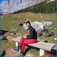
Two hikers are walking the Karwendel High Trail
The Karwendel High Trail demands endurance and sure-footedness and, with its length of 60 kilometers, is actually well manageable for reasonably experienced mountain hikers in six daily stages. In terms of accommodation after the daily stages, there are excellent conditions along the route with its five wonderful mountain huts, where one can refresh the tired body and rest the head.

View of the Karwendel House - Scharnitz
A long-distance hike in 6 acts
Stage 1:
The first stage of the high trail begins at the Reith train station near Seefeld and spans 6.5 kilometers with an elevation gain of 1,150 meters to reach the Nördlinger Hütte, situated at an altitude of 2,239 meters. Along the way, you pass the Schartlehnerhaus. From there, a path leads over the Latschen ridge of the so-called "Schoaßgrat" to the first overnight destination.

Reither Peak at Night - Noerdlinger Hut
Stage 2:
In the second stage, you really dive into the Karwendel and leave "civilization" behind. Strengthened, you set off from the Nördlinger Hut towards Urspungsattel (2,087 m). From there, you continue to Breiten Sattel (1,794 m) and then to Eppzirler Scharte. From there, a path leads down through the Höllkar filled with limestone gravel and then through gentle ups and downs to the Solsteinhaus, the second stage destination. If you feel at home in alpine terrain, are sure-footed, and not afraid of heights, you can alternatively traverse from Urspungsattel along the Freiunger Höhenweg to Eppzirler Scharte. The rock sections are secured with ropes, and it is advisable to bring a via ferrata kit.

Solstein House - Karwendel High Trail Stage
Stage 3:
The third day also brings the longest stage of the Karwendel Höhenweg. Therefore, it's best to depart with the first rays of sunlight from the Solsteinhaus. From there, the route goes downhill towards Möslalm, and at the junction in the "Wilde Iss", one follows the summit climber path past the hunting lodge. Through switchbacks and a ridge covered with trees and mountain pines, you ascend to the so-called "Hippen". A short descent follows, then a very steep climb to the Frau-Hitt-Sattel, which is located west of the Frau Hitt – a prominent rock needle. After descending from the saddle, you continue over the Schmidhubersteig to the Seegrube.
From there, you enjoy a magnificent view over Innsbruck. Then comes the ascent to the Hafelekarhaus, where you turn onto the Goetheweg and follow it to the Pfeishütte. On the Goetheweg, two worlds converge, so to speak: the rugged Karwendel mountains and the Inn Valley. Those who wish to avoid the steep ascent from the Seegrube to the Hafelekar can alternatively take the Hafelekar cable car.


Stage 4:
The fourth stage begins where the third one ended, namely at the cozy Pfeishütte. From there, it goes over the Stempeljoch and the Lafatscher Joch to the Bettelwurfhütte. After leaving the Stempeljoch behind, you reach the so-called Wilde Bande Steig, named after the mountaineering society of the same name, founded in 1878.
Stage 5:
On the fifth day, there is a relatively leisurely hike to the Hallerangerhaus. From the Bettelwurfhütte, the eagle's nest of the Karwendel, we return to the Lafatscher Joch and from there descend through the area between Lafatscher, Roßkopf, and Speckkarspitze to the Hallerangerhaus.


Stage 6:
The last stage from Hallerangerhaus to Scharnitz leads along the Isar in the Hinterautal and invites you to relax one more time after some more challenging stages, to recharge your energy by the turquoise shimmering river and to reflect on the experiences gained while walking.


Of course, the high trail can also be completed in the opposite direction, but this variant is undoubtedly recommended.
Mountain Culinary
Because an empty stomach not only dislikes studying but also doesn't function well, the Karwendel High Trail offers quite a lot in culinary terms as well. All huts have committed themselves, as part of the Alpine Club initiative "This is how the mountains taste," to use regional products as much as possible in their kitchens. This also helps to preserve the alpine cultural landscape shaped by the hard work of diligent mountain farmers.


Facts
Packing Tips for the Karwendel High Trail
A backpack that is too heavy is not easy to carry and negatively affects traction. Therefore, here are some helpful suggestions.
It is common among experienced mountaineers to follow the layering principle regarding clothing, which states that multiple thin layers are better than a single thick layer. Since the weather can be unpredictable in high mountain areas, one should anticipate changes in weather and be prepared for them. As a general rule for packing a backpack, one should take as much as necessary and as little as possible.
Checklist:
- Mountaineering shoes (ankle-high)
- Functional underwear
- Breathable shirt or blouse
- Fleece pullover or jacket
- Weatherproof jacket with hood (wind and water-resistant)
- Long pants
- Hiking socks
- Hat and fingerless gloves
- Spare clothing
- Backpack (35-45 liters) with rain cover
- Hiking maps and guides
- Sun protection (cream, glasses, headgear)
- Water bottle (min. 1.5 liters)
- Emergency supplies (granola bars, dextrose)
- First aid kit
- Mobile phone
- Cramp-on (simple crampon style for shoes)
- Trekking poles
- Headlamp
- Bivvy sack
- Shelter sleeping bag and shoes
- Toiletries and towel
- Starter Kit Karwendel High Trail
Tips for Long-Distance Hiking:
Physical fitness, stamina, and traction are the fundamentals that decide the route selection. Before setting off, one should study the route closely: Where are the supply stations, huts (check opening hours and sleeping places), and possible emergency shelters? Are there passages that should be better avoided? And if so, how? Is special equipment required (harness, helmet, crampons, etc.)? Is the chosen route passable everywhere? Check the weather forecast before the trip!
Please take note!
Mountain emergency call: 140
European emergency number: 112
More information about the Karwendel high trail:
Karwendel high trail
Instagram - Karwendel high trail
Karwendel high trail - Facebook
Seefeld - Tirol's high plateau: Karwendel high trail
This post is an article from the regional magazine zeit.los. More complete zeit.los magazines with all stories are also available online to browse and explore!




















Share