A True Nature Experience

A True Nature Experience

Hiking in the Karwendel Nature Park

Covering 739 km², the Karwendel Nature Park is Tyrol’s largest protected area and the biggest nature park in Austria. On Tyrol’s high plateau, an extensive trail network winds through quiet valleys, alpine meadows, wild gorges and untouched forests. Whether you prefer relaxing walks along rushing rivers, scenic hikes to rustic alpine huts, or challenging routes to panoramic peaks – hiking in the Karwendel offers something for every level of fitness.

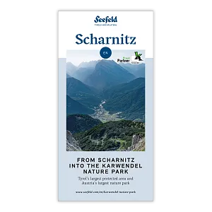
Scharnitz, known as the "Gateway to the Karwendel", is the ideal starting point for hikers, mountaineers and nature lovers. The central contact point is the Nature Park Information Centre in Scharnitz, located directly at the P2 "Karwendelparkplatz Länd" car park. From May to October, visitors can find tour information, brochures and hiking maps here. Right next to it is the Holzerhütte Museum, which offers fascinating insights into traditional alpine forestry in the Karwendel. Four valleys – the Karwendeltal, Hinterautal, Gleirschtal and Gießenbachtal – along with the Arnspitz mountain range, are just waiting to be explored.

Leutasch, on the northwestern edge of the Karwendel, provides access to more remote trails in the Arnspitze region. Routes from here lead to the striking Große Arnspitze as well as to quieter paths beneath towering peaks – perfect for those who want to enjoy hiking off the beaten track. Seefeld and Reith also offer access to the southwestern corner of the Karwendel – the Erlspitz Group, also known as the “Seefeld Range.”

Hinterautal Valley & the Source of the River Isar

The peaceful Hinterautal Valley follows the crystal-clear waters of the river Isar all the way to its source, known as “Bei den Flüssen” (At the Rivers). In the valley, charming alpine huts invite you to pause and relax in this idyllic setting.

Alle

Medium

Hard

Isarursprung im Karwendel - Scharnitz (3).jpg

Hiking

Hike to the source of the river Isar & Kasten alpine hut

Length

28,20 km

Duration

06:00 h

Uphill

323 hm

Altitude

1227 hm

Difficulty

Medium

Bikepause an der Isarquelle.jpg

Hiking

Bike & Hike Halleranger house - Halleranger alm

Length

38,00 km

Duration

06:00 h

Uphill

832 hm

Altitude

1768 hm

Difficulty

Medium

Hallerangeralm

Hiking

Bike & Hike Sunntigerspitze Summit, 2,321 m

Length

42,00 km

Duration

09:00 h

Uphill

1396 hm

Altitude

2321 hm

Difficulty

Medium

Sonnenaufgang im Karwendel_Speckkarspitze

Hiking

Bike & Hike Speckkarspitze, 2,621 m

Length

44,00 km

Duration

11:00 h

Uphill

1794 hm

Altitude

2621 hm

Difficulty

Hard

Pleisenhütte im Sommer - Scharnitz - quer.jpg

Hiking

Hike to the Pleisen alpine hut

Length

15,90 km

Duration

05:00 h

Uphill

780 hm

Downhill

774 hm

Altitude

1757 hm

Difficulty

Medium

Drohnenaufnahme Pleisenspitze im Sommer.jpg

Hiking

Hike to the Pleisenspitze Summit, 2,569 m

Length

20,10 km

Duration

10:30 h

Uphill

1600 hm

Altitude

2569 hm

Difficulty

Hard

Karwendeltal Valley

A pristine valley featuring challenging ascents for both hikers and bikers. At the end of the valley, the Karwendelhaus sits proudly at 1,765 metres, offering visitors sweeping panoramic views. It serves as a starting point for many alpine tours and marks the first stage of the legendary Karwendel March.

Alle

Medium

Hard

Durchs Karwendeltal aufs Karwendelhaus - Scharnitz

Hiking

Hike to the Karwendelhaus

Length

36,00 km

Duration

11:15 h

Uphill

839 hm

Altitude

1765 hm

Difficulty

Hard

Wanderung über der Karwendelschlucht - Scharnitz.jpg

Hiking

Circular hiking trail Karwendel Gorge

Length

8,90 km

Duration

03:00 h

Uphill

240 hm

Altitude

1140 hm

Difficulty

Medium

Wasserfall beim Karwendelsteg mit angeschnittenem Baum.jpg

Hiking

Circular hiking traill Karwendelsteg/Karwendelschlucht

Length

8,60 km

Duration

03:00 h

Uphill

352 hm

Altitude

1144 hm

Difficulty

Medium

Falkenhütte neu

Hiking

Karwendelmarsch 52 km

Length

52,00 km

Duration

19:00 h

Uphill

2281 hm

Downhill

2217 hm

Altitude

1903 hm

Difficulty

Hard

Bike-Tour-durchs-Karwendeltal-aufs-Karwendelhaus

Hiking

Bike & Hike Birkkarspitze Summit, 2,749 m

Length

41,00 km

Duration

09:00 h

Uphill

1800 hm

Altitude

2749 hm

Difficulty

Hard

Karwendelmarsch 2018 (13).jpg

Hiking

Karwendel March 35 km

Length

35,00 km

Duration

12:30 h

Uphill

1664 hm

Downhill

1358 hm

Altitude

1843 hm

Difficulty

Hard

Wanderung auf die Birkkarspitze - Scharnitz (65).jpg

Hiking

Hike from the Karwendelhaus to the Hinterautal

Length

9,20 km

Duration

07:00 h

Uphill

883 hm

Altitude

2642 hm

Difficulty

Hard

Brunnsteinspitze mit Gipfelkreuz - Scharnitz (4).jpg

Hiking

Hike to the Brunnsteinspitze Summit, 2,180 m

Length

13,00 km

Duration

08:30 h

Uphill

1368 hm

Altitude

2180 hm

Difficulty

Hard

Brunnsteinhütte

Hiking

Hike to the Brunnsteinhütte

Length

10,00 km

Duration

04:30 h

Uphill

668 hm

Altitude

1523 hm

Difficulty

Medium

Gleirschtal Valley & Gleirsch Gorge

A quiet valley with access to Möslalm, Pfeishütte, Kristenalm and Solsteinhaus. One of its highlights is the impressive Gleirschklamm Gorge, where a narrow trail follows the rushing mountain stream through a spectacular rocky landscape.

Alle

Medium

Hard

Durch die Gleirschklamm bei Scharnitz.jpg

Hiking

Circular hiking trail Gleirschklamm Gorge

Length

13,10 km

Duration

04:00 h

Uphill

416 hm

Downhill

410 hm

Altitude

1152 hm

Difficulty

Medium

Gleirschklamm - Scharnitz (17).jpg

Hiking

Hike through the Gleirschklamm to the Möslalm

Length

21,20 km

Duration

06:30 h

Uphill

505 hm

Downhill

498 hm

Altitude

1261 hm

Difficulty

Medium

Durch die Gleirschklamm - Scharnitz (1).jpg

Hiking

Circular hike through the Gleirsch Gorge and over the Zäunlkopf

Length

17,90 km

Duration

06:45 h

Uphill

907 hm

Altitude

1744 hm

Difficulty

Medium

Spaziergang an der Isar - Scharnitz (2).jpg

Hiking

Circular hiking trail to the Gleirschhöhe

Length

8,60 km

Duration

02:45 h

Uphill

212 hm

Altitude

1074 hm

Difficulty

Medium

Kristenalm

Hiking

Bike & Hike Kristenalm

Length

25,00 km

Duration

04:00 h

Uphill

420 hm

Altitude

1249 hm

Difficulty

Medium

Solsteinhaus Etappe 2 Ziel & 3 Start

Hiking

Hike to the Solsteinhaus

Length

22,00 km

Duration

08:00 h

Uphill

940 hm

Downhill

975 hm

Altitude

1803 hm

Difficulty

Hard

Gravelbike - Zum Isarursprung.jpg

Hiking

Bike & Hike Hoher Gleirsch Summit, 2,492 m

Length

31,00 km

Duration

09:30 h

Uphill

1772 hm

Altitude

2492 hm

Difficulty

Hard

Gießenbachtal Valley

Starting from Gießenbach, this wild and romantic valley opens up – ideal for those looking to enjoy some peace and quiet in nature.

Alle

Medium

Hard

Nördlinger Hütte - Hütte mit Blick ins Inntal Richtung Süden (1).jpg

Hiking

Circular hike via Eppzirler Alm and Nördlinger hut to Seefeld

Length

20,40 km

Duration

10:00 h

Uphill

1464 hm

Altitude

2231 hm

Difficulty

Hard

Wanderung Oberbrunnalm im Karwendel - Scharnitz (1).jpg

Hiking

Circular hike over Zäunlkopf & Oberbrunnalm alpine hut

Length

15,20 km

Duration

06:00 h

Uphill

794 hm

Downhill

789 hm

Altitude

1743 hm

Difficulty

Medium

Wanderung zur Eppzirler Alm im Sommer - Mann und Frau von hinten mit Eppzirler Alm.jpg

Hiking

Hike to the Eppzirler Alm alpine hut

Length

12,40 km

Duration

04:00 h

Uphill

475 hm

Altitude

1459 hm

Difficulty

Medium

Arnspitz Group

With the addition of the Arnspitze nature reserve, the Karwendel Nature Park expanded to 739 km². The municipality of Leutasch now offers new access points into the rugged Arnspitz Group. This little-explored corner of the Karwendel features both technically demanding mountain tours and more leisurely hiking routes.

Alle

Medium

Hard

Gipfel Grosse Arnspitze - Scharnitz

Hiking

Hike to the Große Arnspitze Summit, 2,196 m

Length

9,00 km

Duration

07:30 h

Uphill

1247 hm

Altitude

2196 hm

Difficulty

Hard

Blick auf Arnspitzen Ueberschreitung - Scharnitz

Hiking

Mountain tour crossing of the Arnspitzen

Length

11,50 km

Duration

08:30 h

Uphill

1353 hm

Altitude

2196 hm

Difficulty

Hard

Grosse Arnspitze Blick ins Karwendel - Scharnitz

Hiking

Hike Hoher Sattel - Große Arnspitze Summit, 2,196 m

Length

10,30 km

Duration

08:00 h

Uphill

1313 hm

Altitude

2196 hm

Difficulty

Hard

Wanderweg zur Hohen Fluder mit Blick Richtung Hohe Munde.jpg

Hiking

Hike Hoher Sattel

Length

10,60 km

Duration

04:00 h

Uphill

524 hm

Altitude

1620 hm

Difficulty

Medium

Ausblick von der Arnplattenspitze auf die Gehrenspitze, Hohe Munde

Hiking

Circular hike Arnplattenspitze, 2,171 m

Length

8,60 km

Duration

07:00 h

Uphill

1106 hm

Altitude

2171 hm

Difficulty

Hard

Erlspitz Group

Also known as the Seefeld Range, the Erlspitz Group forms the southwestern edge of the Karwendel Mountains. Trails from Seefeld and Reith lead across striking ridges, varied passes, and scenic peaks, offering impressive views over the Karwendel valleys.

Nördlinger Hütte - Wanderer kurz vor der Hütte (2).jpg

Hiking

Circular hike to the Nördlinger Hütte alpine hut & Reither Spitze Summit, 2,374m

Length

9,90 km

Duration

07:30 h

Uphill

1191 hm

Altitude

2374 hm

Difficulty

Hard

Wanderer auf dem Weg vom Seefelder Joch zur Seefelder Spitze - Gipfelkreuz der Spitze im Blick.jpg

Hiking

"Königstour" The royal's hiking tour

Length

4,40 km

Duration

03:00 h

Uphill

502 hm

Downhill

464 hm

Altitude

2364 hm

Difficulty

Hard

Seefelder Spitze im Sonnenuntergang

Hiking

Hiking to the Seefelder Spitze, 2,221 m and Seefelder Joch 2,060 m

Length

7,40 km

Duration

04:30 h

Uphill

1010 hm

Downhill

167 hm

Altitude

2221 hm

Difficulty

Medium

Wanderer auf der Seefelder Spitze ueber Seefeld

Hiking

Bike & Hike Seefelder Spitze Summit, 2,220 m

Length

13,00 km

Duration

04:30 h

Uphill

1094 hm

Altitude

2220 hm

Difficulty

Hard

Multi-Day Hikes in the Karwendel Nature Park

Karwendelmarsch 52 km

Hard

Hiking tour

Long distance trails

Start Point: Naturpark Info Center Scharnitz (P2)

End Point: Pertisau Achensee

52,00 km

19:00 h

2281 hm

2217 hm

1903 m

View Map

Karwendel High Trail

Hard

Long distance trails

Start Point: Train Station Reith

End Point: Nature Park and Information Centre Scharnitz

70,00 km

27:30 h

4470 hm

4600 hm

2699 m

View Map

wanderung-auf-die-birkkarspitze-scharnitz-3

Eagle Walk

The Eagle Walk covers 33 stages, stretching across approximately 413 kilometres and climbing a total of 31,000 vertical metres. It crosses seven mountain ranges on its way through Tyrol and leads through the Karwendel Nature Park from stage 8 to stage 15. All details, including route descriptions and maps, can be found at tirol.at/eagle-walk.

Guided Hikes in the Karwendel Nature Park

Our experience shop offers two guided hikes through the Karwendel Nature Park. In addition, you can plan customised tours together with the region’s experienced mountain and hiking guides – and discover the diverse natural beauty of the Karwendel along the way.

Taxi Rides into the Valleys and Boat Transport into Hinterautal

From 1ˢᵗ June to 15ᵗʰ October every year

Taxi and Minibus Mair – Scharnitz T. +43 5213 5363
Taxi Ramona – Giessenbach T. +43 5213 5541

Please contact the companies directly for information about rates and availability.

Code of Conduct

Your safety and the protection of our unique nature are very important to us. Please enjoy this beautiful landscape with respect. By following these ten simple rules, you actively contribute to preserving this natural paradise.

Commercial filming and photography in the Karwendel Nature Park are becoming increasingly popular. However, due to the area's special protected status, official permission and compliance with specific rules are required. Detailed information on how to apply for a filming or photography permit can be found on this page.

Please also follow the general rules of conduct for the Karwendel Nature Park.

01

02

karwendelfolder-en-1
Karwendelfolder
From Scharnitz into the Karwendel Nature Park
Download
paar-auf-wanderung-in-der-region-seefeld-gaistal-leutasch-4

Hiking in the Region Seefeld

All Hiking trails
The extensive hiking area of the Region Seefeld offers you a variety of hiking trails through untouched nature. With our practical route finder you get an overview of the entire hiking routes and can select them according to difficulty, route length, walking time and much more.

Tourismusverband Seefeld | Austria +43 5 0880 | region@seefeld.com | www.seefeld.com